Travel around Siguniang mountain and embrace the most beautiful lady in Shushan
It's said that a long time ago, in a place called rilong town in Aba Prefecture in the west of Sichuan Province, there lived a family called abalangyi in the village. He had four daughters, each of whom was bright and beautiful.
Unfortunately, there are torrential rains and torrential floods, and people are suffering from disasters. Abalanyi hears that the one who caused the disaster is a devil called murdora, so he resolutely duels with the devil in exchange for people's peace and prosperity. However, abaran was killed by the devil because of his old age. Before he died, he turned into a mountain range to block the torrents for one side of the people.
In order to fulfill his father's last wish, his four daughters designed to kill the great demon king. However, the Bank of Tianhe was opened by the dying great demon king with magic, and the flood still damaged the lives here. So the four girls sacrificed themselves to block the water, turned into four peaks, and exchanged their young lives for the living space of the people. This is the beautiful legend of Siguniang mountain.
Meet Siguniang mountain for the first time

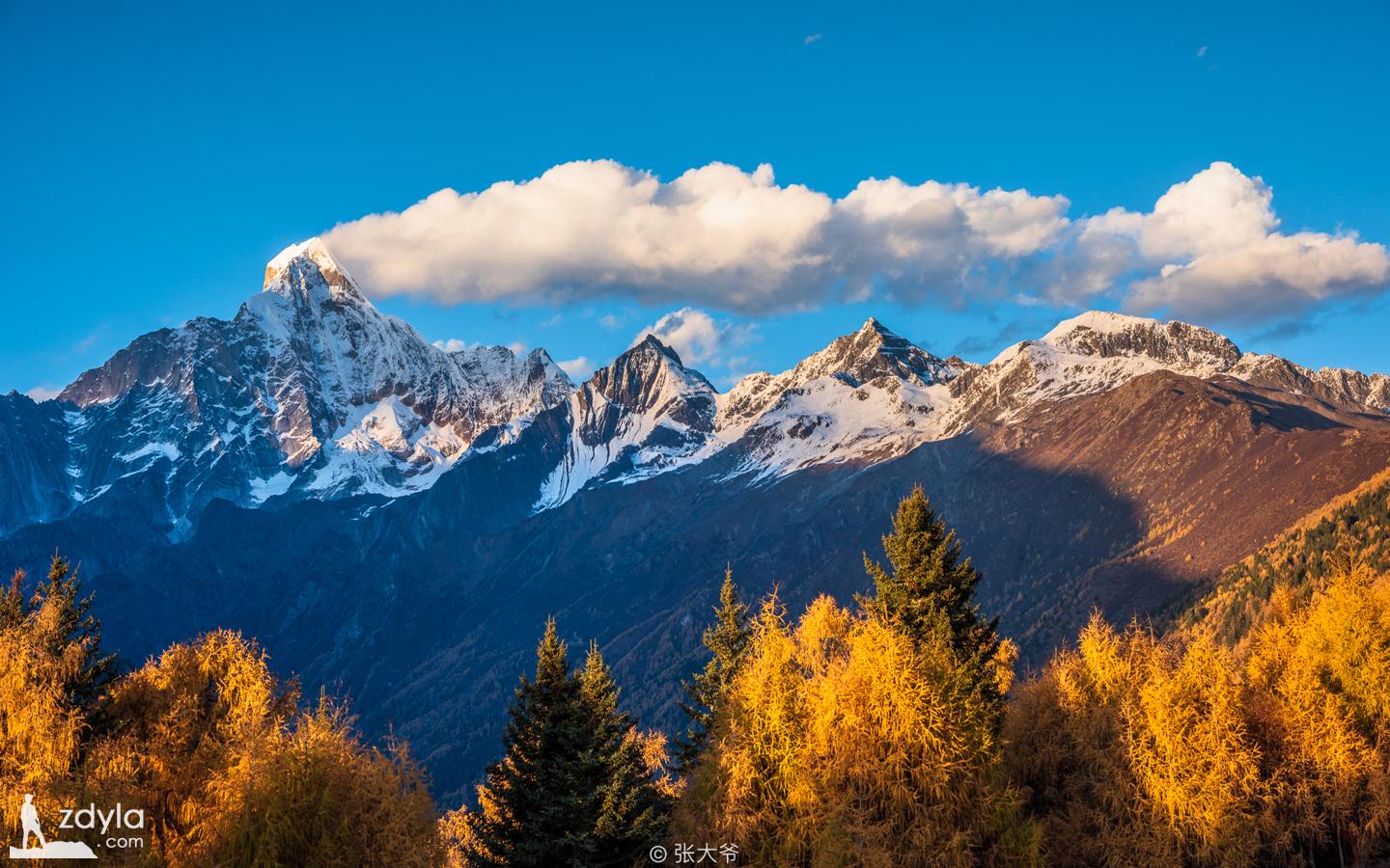
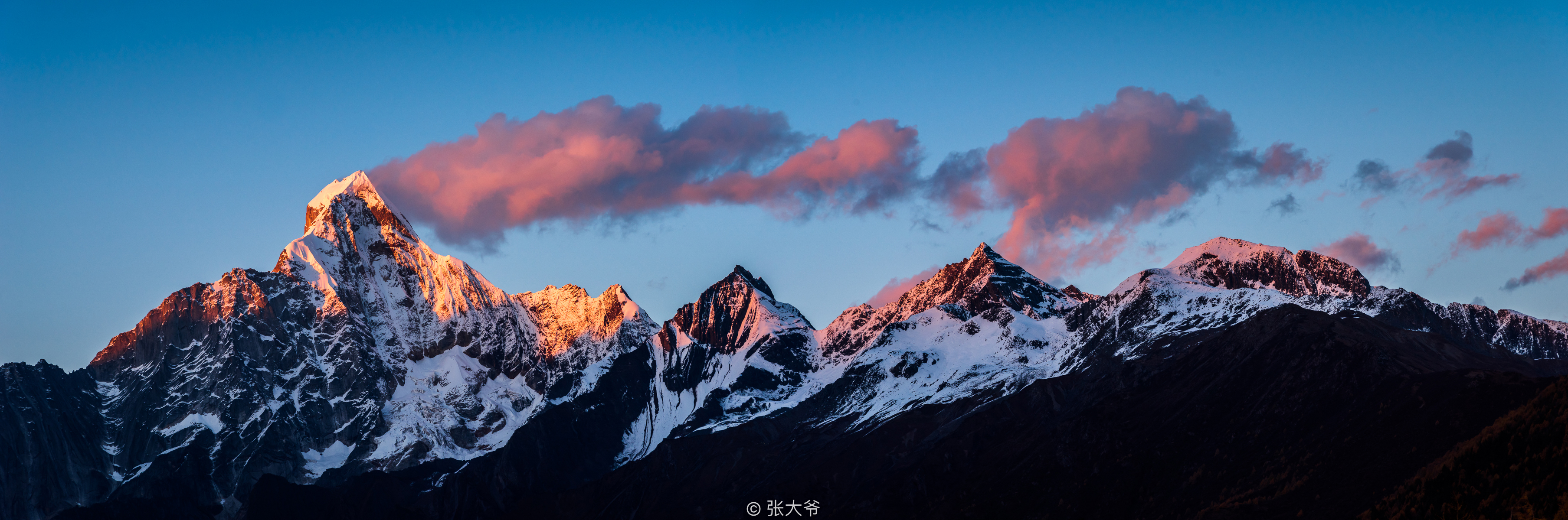
Siguniang mountain, located at the junction of Xiaojin county and Wenchuan County in Aba Tibetan and Qiang Autonomous Prefecture in Western Sichuan Province, consists of four continuous peaks, which is the highest peak of Qionglai mountain system on the eastern edge of Hengduan Mountain range.
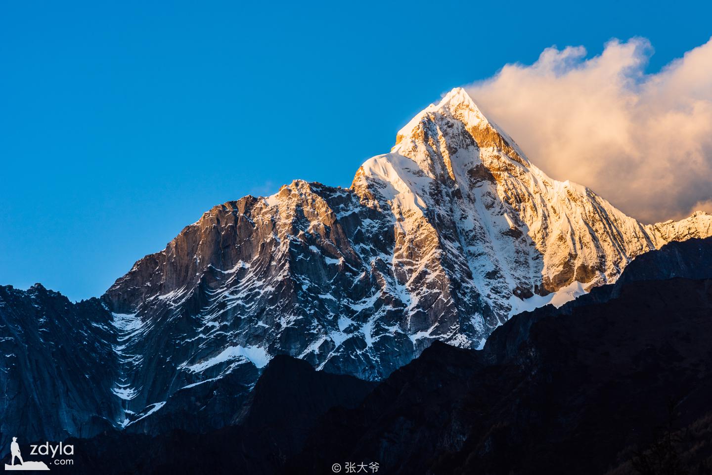
People often talk about "four girls", in fact, "Yaomei peak", which is 6250 meters above sea level. It is the highest peak among the four peaks and the second highest peak in Sichuan Province. Because of its beautiful appearance, it is known as "behind the Shushan mountain" and "the Oriental Alps". It is far away from Gongga Mountain, the king of the Shushan mountain. On her side are her three sisters, the third, the second and the eldest, who are 5355, 5276 and 5025 meters above sea level.
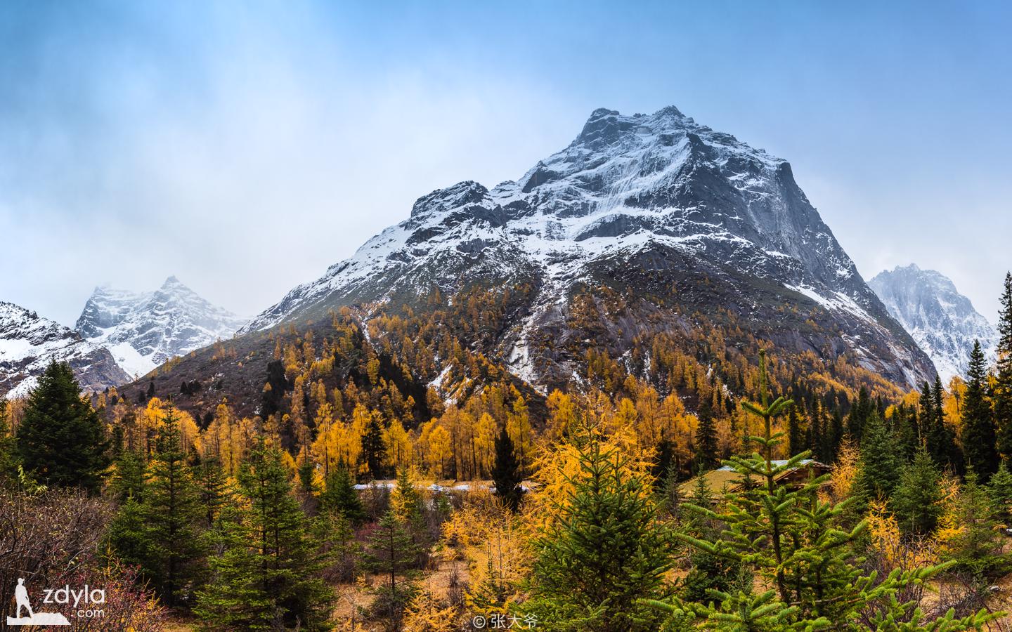
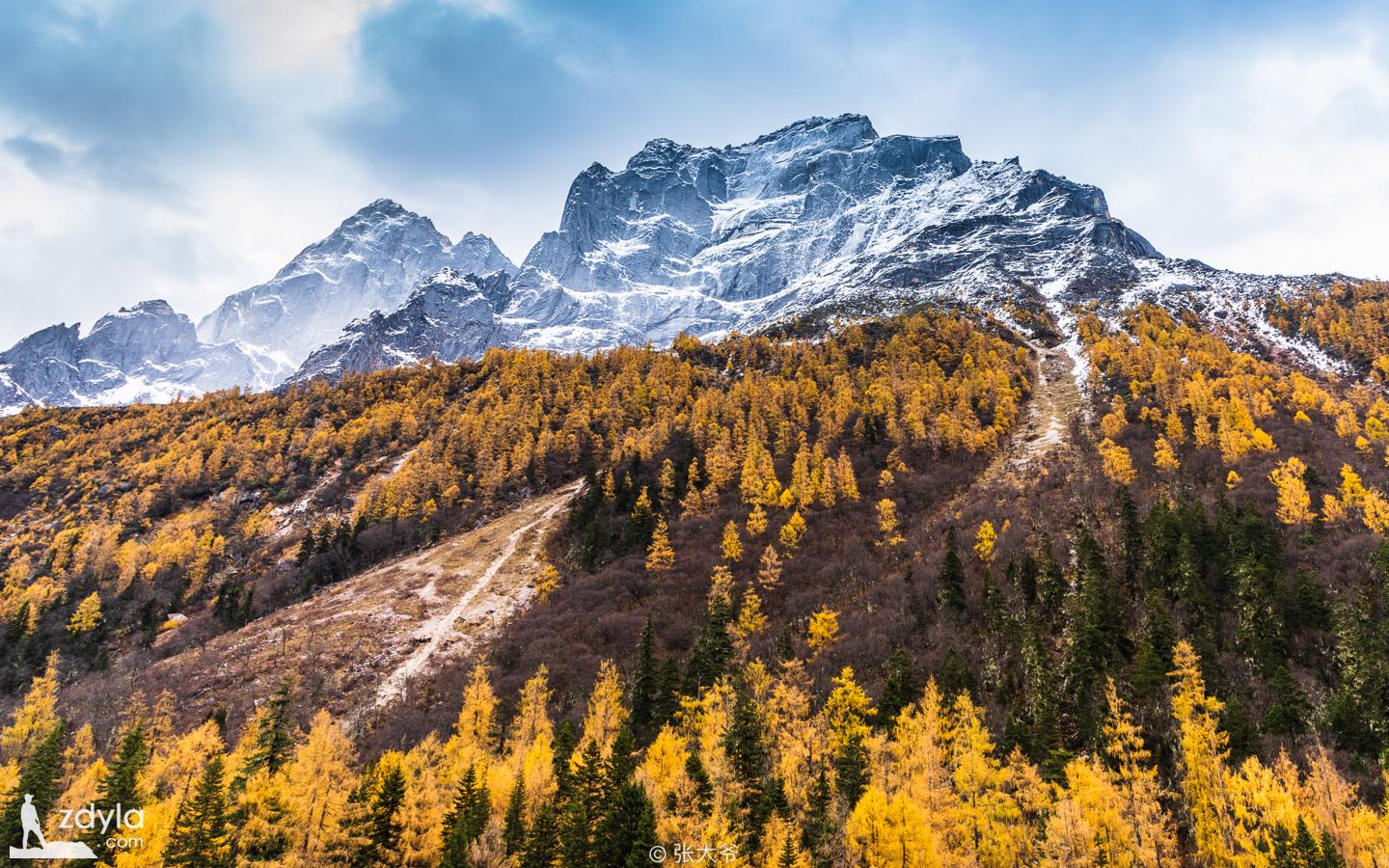
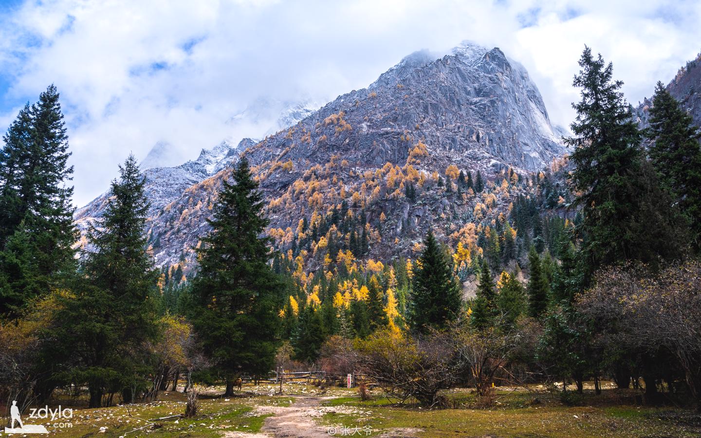
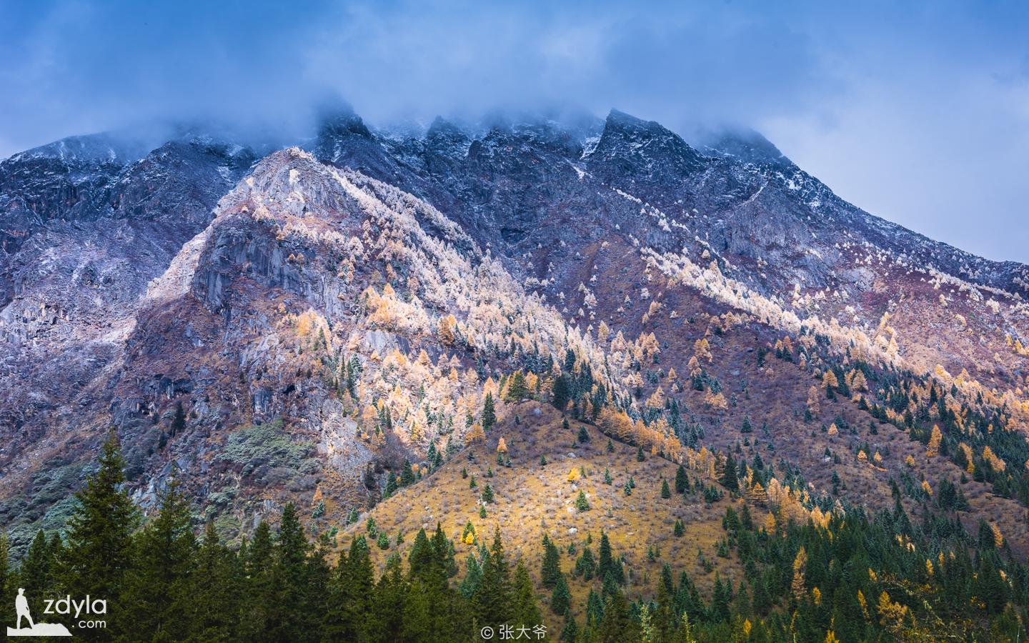
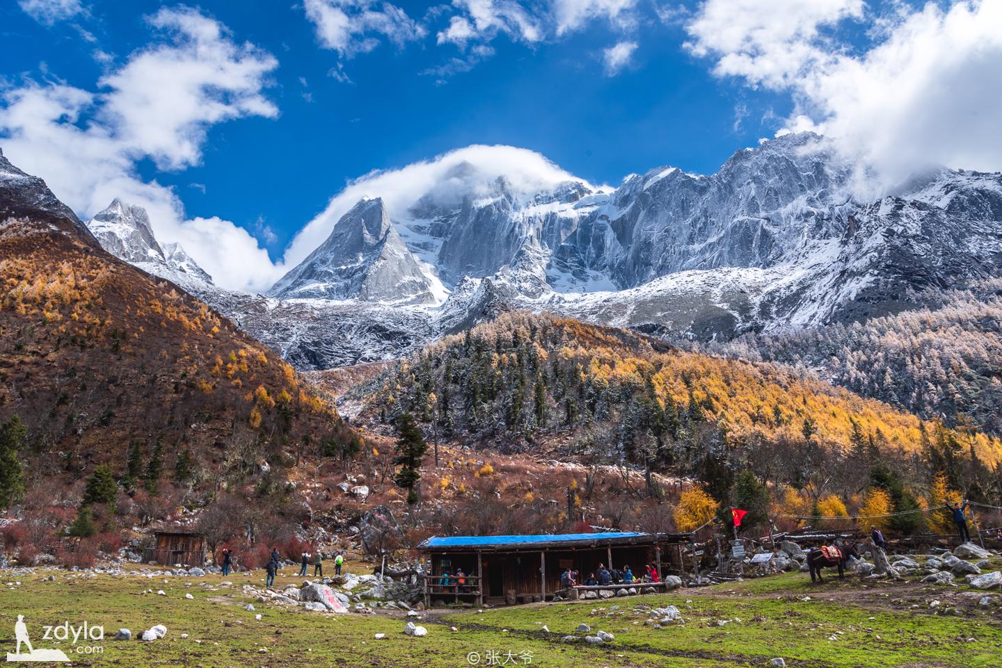
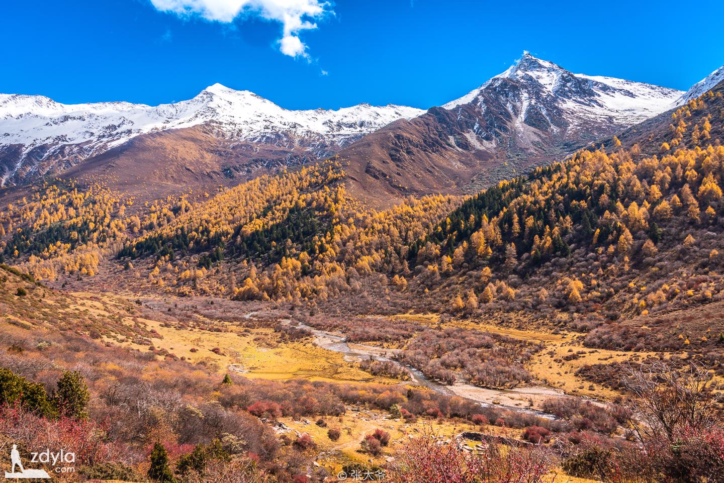
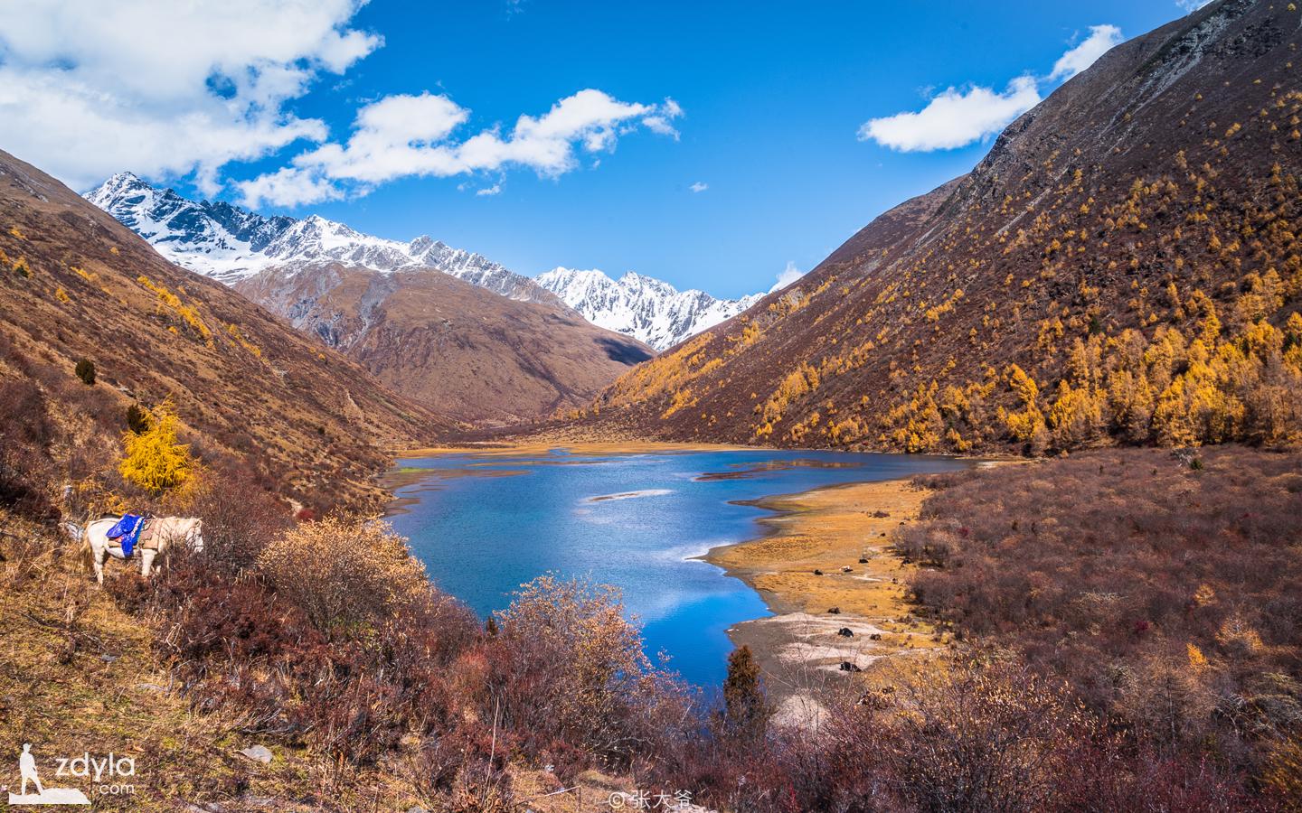
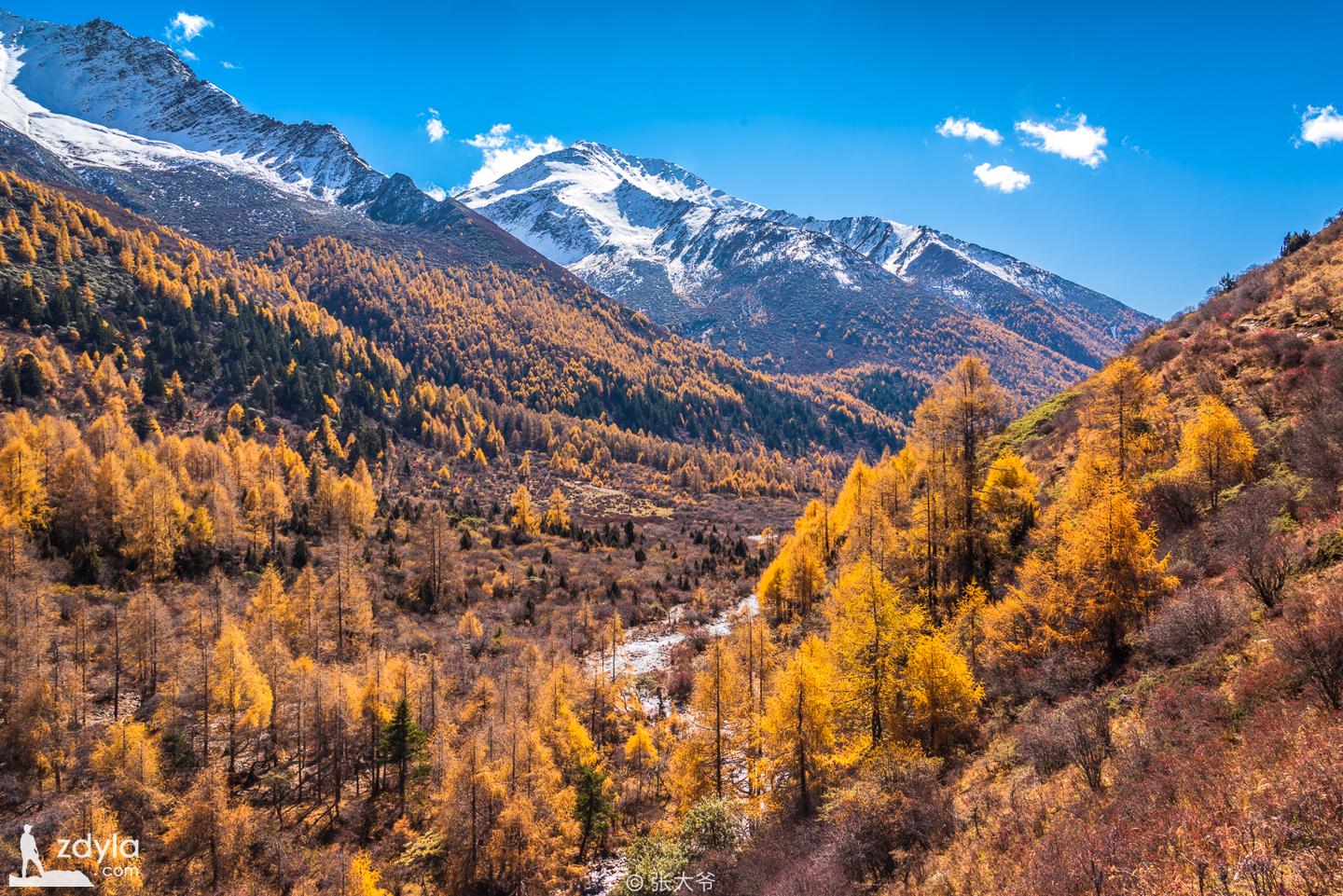
The four seasons of Siguniang mountain are good at its beauty. Because of its special geographical location, climatic conditions and significant altitude difference, it provides an ideal living environment for all kinds of animals and plants. Then there is a strange landscape composed of strange peaks, different trees, waterfalls, flowing springs and meadow streams.
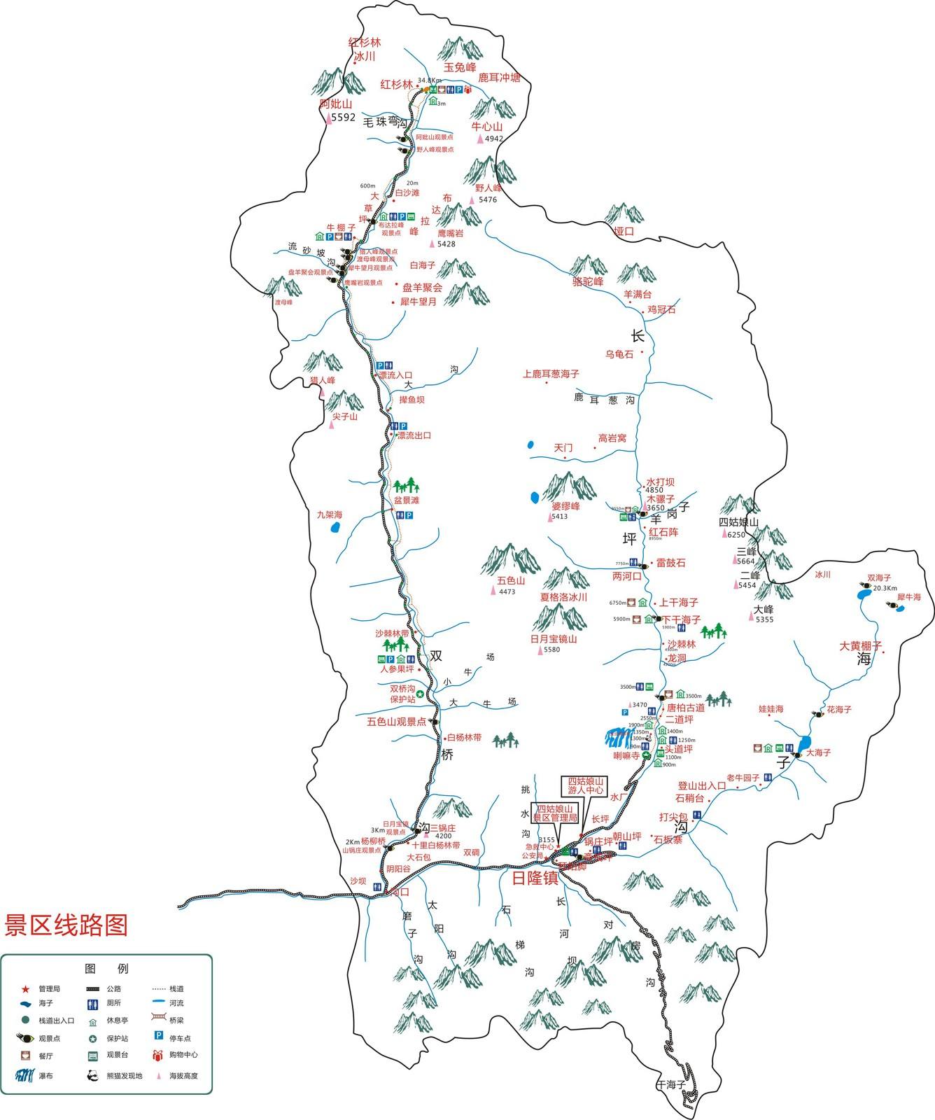
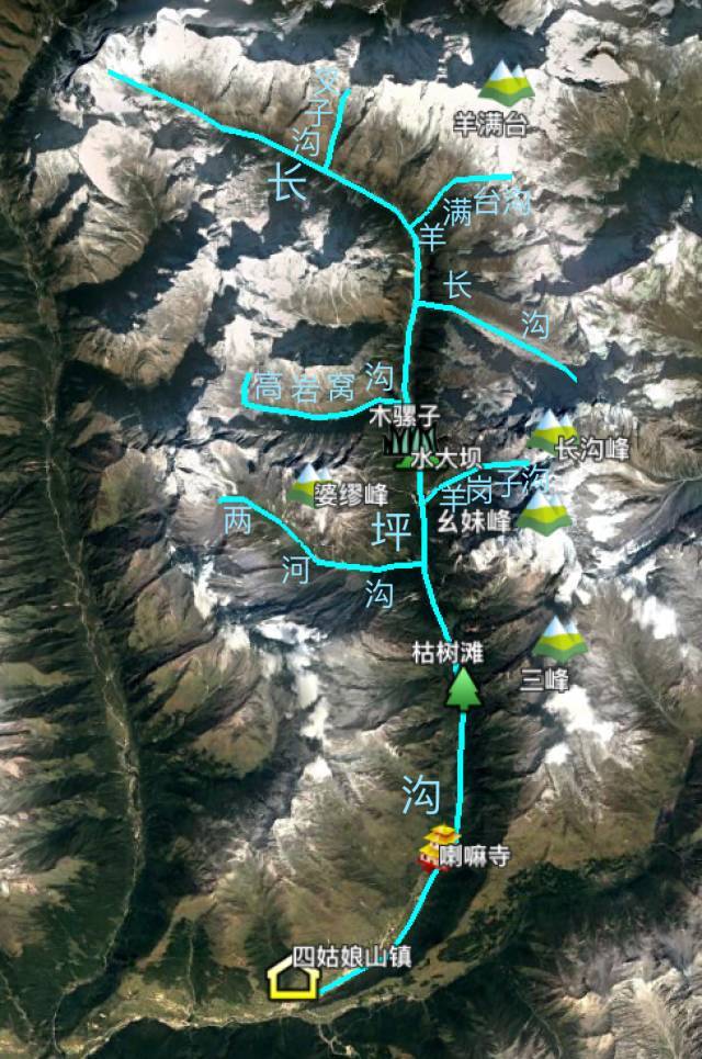
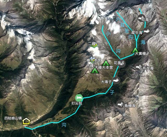
The first three beautiful valleys at the foot of the mountain are shuangqiaogou, changpinggou and Haizigou. The style of each ditch is extremely outstanding, and the landscape is different. Playing in it will surely feast your eyes.
Shuangqiaogou
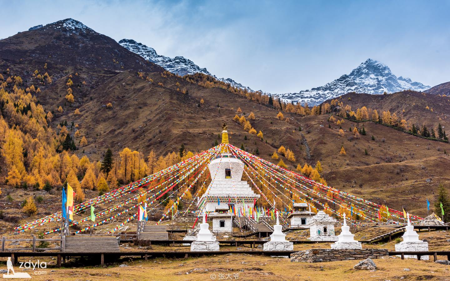
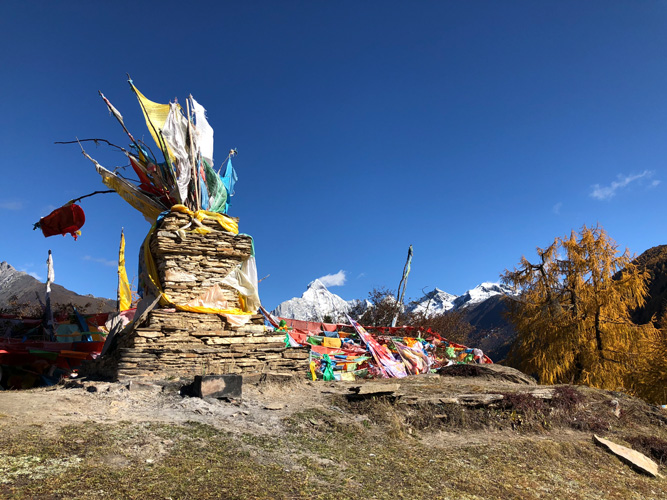
White Pagoda
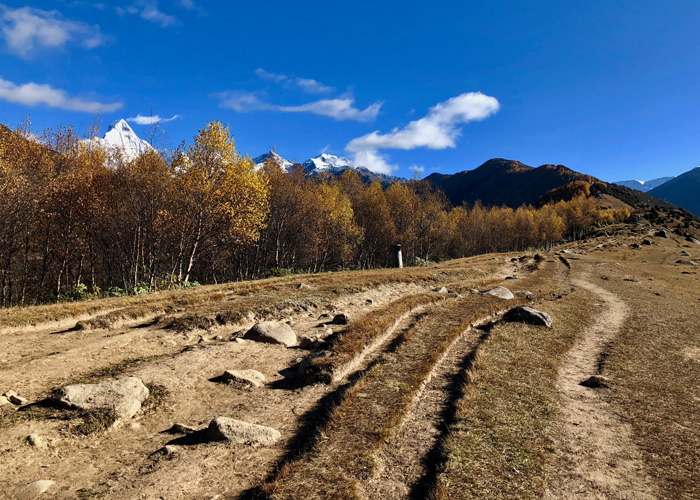
Shuangqiaogou, long for sightseeing, has a depth of more than 30 kilometers. The canyon is wide and narrow, with a width of up to several kilometers. The slope is covered with a wide lawn, and the stream is gentle and winding. The Seabuckthorn trees on both sides of the river are like a green dragon stretching for several kilometers. And every autumn, when the leaves turn red, it is a scene again.
As the scenic area is too large, it is recommended that tourists complete the tour by car and foot. It is too hard to complete the tour only by foot. It will take at least three hours to complete the tour. It is better to arrive in the morning to watch it. The late one should also arrive at noon. If they go again at two or three in the afternoon, they will catch the last shuttle all the way. What they watch is not the scenery, but they are urged and distracted by it all the way.
Long Zhuo Lake
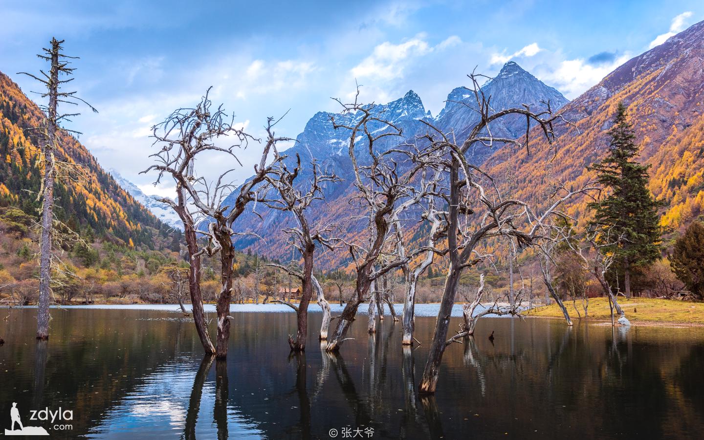
On the lake of longzhucuo, dozens of seabuckthorn trees naturally form a enchanting landscape because of their perennial immersion

Hunter peak
See segment of a whole
Mount Kumgang · Potala
There are more than ten snow mountains with an altitude of more than 4000 meters, so it is called "Snow Mountain Museum".
Changpinggou
Changpinggou, based on the ecological environment, is covered with primitive forests, just like a natural oxygen bar. Changpinggou has a total length of 29 kilometers and an area of about 100 square kilometers. The valley is long, gentle and long. Siguniang mountain is 16 kilometers away from the valley.

Lama Temple
Changpinggou starts from the Lama Temple, which is nearly 7 kilometers away from the ticket office of the scenic spot. The scenic spot provides an inter district bus to the Lama Temple, which costs 20 yuan.
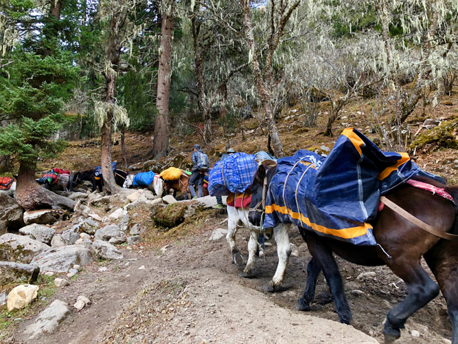
Local people will also provide horse riding service in the ditch. According to the charge of the road leader, it usually takes 200 RMB from the Lama Temple to the mule.
Tour route: Lama Temple, insect horn waterfall, dead tree beach, shangganhaizi, xiaganhaizi, hongshitan, mule
The end of the inter district bus is the gate of changpinggou. You can walk 3 kilometers along the wooden plank road laid in the scenic spot to reach the dead tree beach, which is the end of the wooden plank road and the end of the leisure trail.
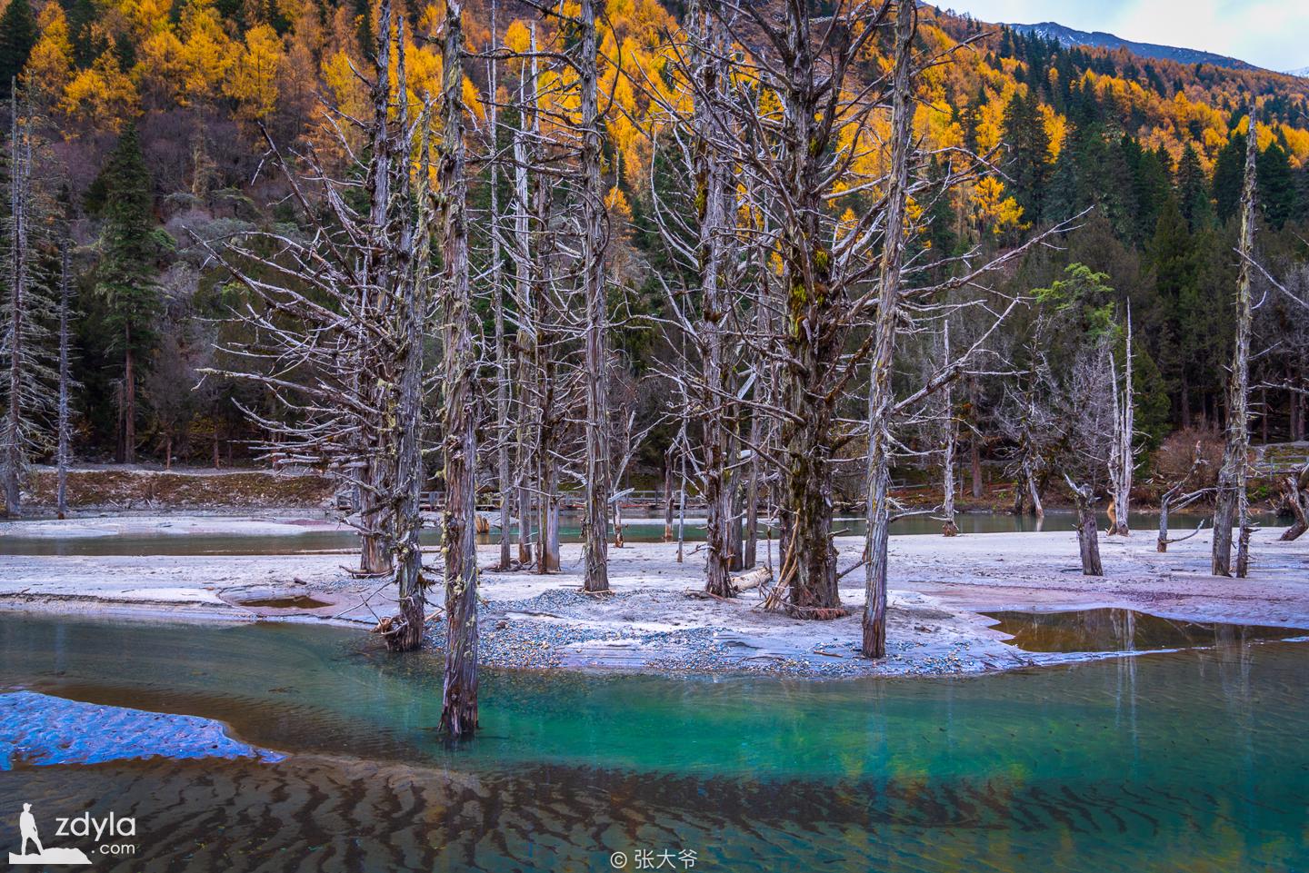
Withered tree beach
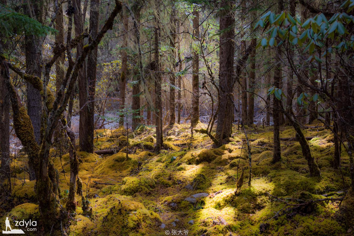
Then you can walk on the mountain road. The valley is lush with trees and beautiful scenery, but the humid air is full of it. Many big stones are covered with moss. When passing by, you should be careful not to slip! Flattery shuttles between trees, the road will be trodden into potholes, and the stream will be muddy. Therefore, after walking, you need to be careful.
When you hike to 10km, you will arrive at mules. This is a grassland, at the foot of the north of Siguniang mountain. You can look up at the snow mountain glacier as if it is in front of you.
If you go further, you can bypass Siguniang mountain and cross through bipeng ditch to Lixian County. There are many dangers in the mountains and forests. You need guide support when you start. Not a senior donkey, please don't try!
Haizigou
Haizigou is mainly a hiking expedition with a total length of 19.2km and an area of 126.48km2. From Guozhuang Ping to the end of Haizigou, the terrain is like a huge dragon, so the local people also call it "dragon head up". Every year, there will be a grand Chaoshan meeting in the ditch to pray for good weather.
Chaoshan Ping
The tour of Haizigou is not at the bottom of the valley, but on the ridge or hillside on one side of the valley. The ups and downs of the mountain road require the physical support of the tourists. Therefore, Haizigou is very popular with hikers.
Zhaijie Ping
Local people will also provide horse riding services in Haizigou. Generally, it takes 100 RMB from Changping village to zhaijieping, 200 - 300 RMB from Changping village to Dahaizi, and another 50 RMB from huahaizi.
Route: Changping village - baigujiao - zhaijieping - guozhuangping - Chaoshanping - shireban - tip bag - laoniuyuanzi - Dahaizi - huahaizi
Generally, hikers hike to Dahaizi or huahaizi along the hiking route designed by the scenic spot. The starting point of the hike is about 3km from Changping village to guozhuangping, 8km from guozhuangping to laoniuyuanzi, 2km from laoniuyuanzi to Dahaizi, 2km from Dahaizi to huahaizi and 8km from huahaizi to shuanghaizi.
Tai Hai Zi
In the early stage of hiking, the roads are all uphill, and the terrain becomes gentle until they cross Chaoshanping. Then, it's very easy to walk to the tip bag. The tip bag protection station is a supply point. People who hike here will eat and drink here. People who don't bring enough food and water can also make a little supplement here. Everyone knows the price in the mountain!
Among them, the big peak climbing and the second peak climbing of Siguniang mountain will pass Haizigou. The tip bag is the bifurcation point of the climbing line and the hiking line. Pay attention to the signboard outside the tip bag, and walk up to the climbing camp, and go straight to Dahaizi!
At this point, the mountain road has become rugged, and from time to time there will be streams running down the mountain. Where the trees cover it, the streams will gather on the road without being dried, and then it will be muddy! There are local people lead the horse through, horse hooves throw a series of mud pits on the road, and then the water forms countless mud pits

It's very difficult to walk on the mountain road. It may be better to shuttle through the trees beside the road, but sometimes people's road is not necessarily better than the road!

You can see Dahaizi 12 kilometers away on foot, and there are more than ten alpine lakes, such as huahaizi, Fuhai, and blue sea. If you want to further explore, it's the same advice: there are many dangers in the mountains and forests, and you need guide support when you start, not senior donkey, please don't try!
Preparation before departure
Best time
In July and August every year, the flowers of Siguniang mountain are in full bloom, which is the best travel season of Siguniang mountain. Another period of time, until October, mid November, it will be colorful forest, colorful autumn
Clothes and clothes
Siguniang mountain is located on the plateau, with strong sunshine. It is very important to prepare sufficient moisturizing and sunscreen skin care products.
There is a big temperature difference between day and night, and the weather in the mountains is changeable. The best choice is to wear a light charge coat or down jacket. Add sweaters, vests and short sleeved T-shirts to your coat, and you can add or remove clothes according to the weather.
During the tour of changpinggou and Haizigou, there are bad roads and muddy roads from time to time. A pair of high top shoes is also needed.
Food, accommodation and transportation
Chengdu chadianzi passenger station has a shuttle bus to Xiaojin county. The ticket price is 95 yuan / person. The bus passes through rilong Town, not far from rilong town is Siguniangshan town. There is a stop at Shiqiao, the entrance of Siguniangshan town. This is the place where food and accommodation get off in Siguniangshan town. If food and accommodation are in rilong Town, you can wait a few kilometers for the bus to drive, and then arrive at rilong town.
Siguniangshan town is two or three kilometers away from rilong town. There are Qinglv inns in both towns. In terms of accommodation, rilong town is relatively rich. The town entrance of Siguniangshan town is changpinggou and Haizigou, but it's far away from shuangqiaogou. It's nearly seven kilometers away. Tourists living in Siguniangshan town are basically carpooling. Qinglv also helps to contact carpooling. Generally speaking, 10-1 5 yuan / person.
Ticket information
Peak season (April 1-November 30): 70 yuan for changpinggou, 20 yuan for sightseeing bus, 80 yuan for shuangqiaogou, 70 yuan for sightseeing bus and 60 yuan for Haizigou.
Off season (December 1-March 30): 50 yuan for changpinggou, 20 yuan for sightseeing bus, 50 yuan for shuangqiaogou, 70 yuan for sightseeing bus and 40 yuan for Haizigou.
Play summary
In addition to the well-developed Shuangqiao ditch, the tour of the other two ditches needs a lot of hiking to complete. It's also OK for brothers with poor physical strength to play half a journey, but it's also a pity. If you really don't believe in the whole hike, it's better to spend money on horse riding, and it's better to decide early. If you can't hold on to the hike, you may not find the horse, or you may be temporarily increased!
The Chaoshanping of Haizigou is definitely a good place to watch Siguniang mountain (such as the bridge of cat's nose), so if there is a need for shooting, don't go too far
There are many secrets in Siguniang mountain. If you are not satisfied, please look forward to the next Siguniang mountain cross-country guide.
- Link : https://www.zdyla.com/en/post/travel-around-the-four-girls-mountain.html
- Copyright Notice : Unless otherwise stated, please contact the author for authorization and indicate the source!