"I" want to wipe out the beautiful scenery of Xinjiang
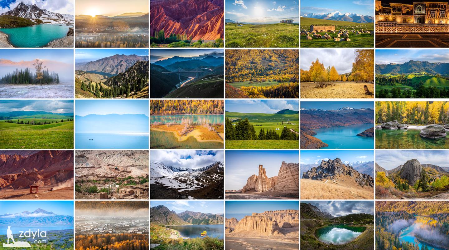
Once, I want to travel all over Xinjiang, now, I finally achieved
Jia Dengyu
"Jiadengyu" in Mongolian means "Jiadeng's house". It is a demonstration base for closing mountains and cultivating forests in burjin county. At present, there are more than 80 mu nurseries, mainly including seedlings of spruce, Larix sibirica, Picea Xueling, Pinus sylvestris, etc.
Wo Mu village
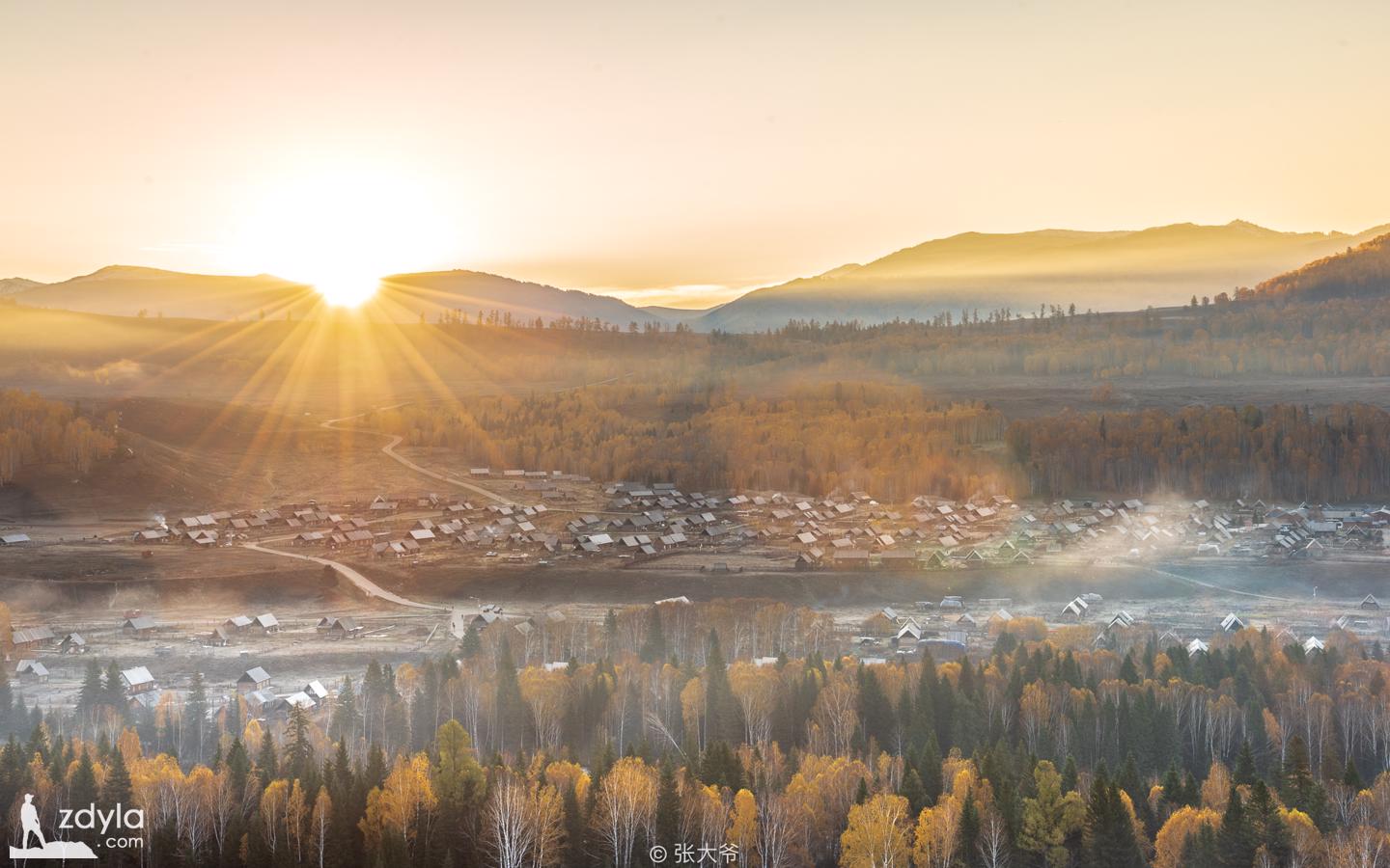
Hemu village is a village under the jurisdiction of burjin County, Xinjiang Uygur Autonomous Region. Located on the Bank of Kanas Lake in burjin County, Xinjiang, it is the concentrated living place of Tuwa people. It is the farthest and largest of the only three Tuwa villages (Hemu village, Kanas village and baihaba Village).
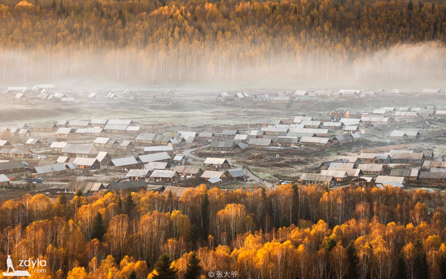
The houses in Hemu village are all made of logs, full of primitive flavor. The most famous is Wanshan's red and intoxicating autumn color. The cooking smoke rises slowly in the autumn color, forming a dreamlike smoke belt, which is better than fairyland.
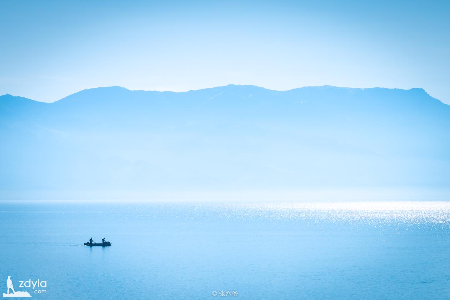
Kanas Lake
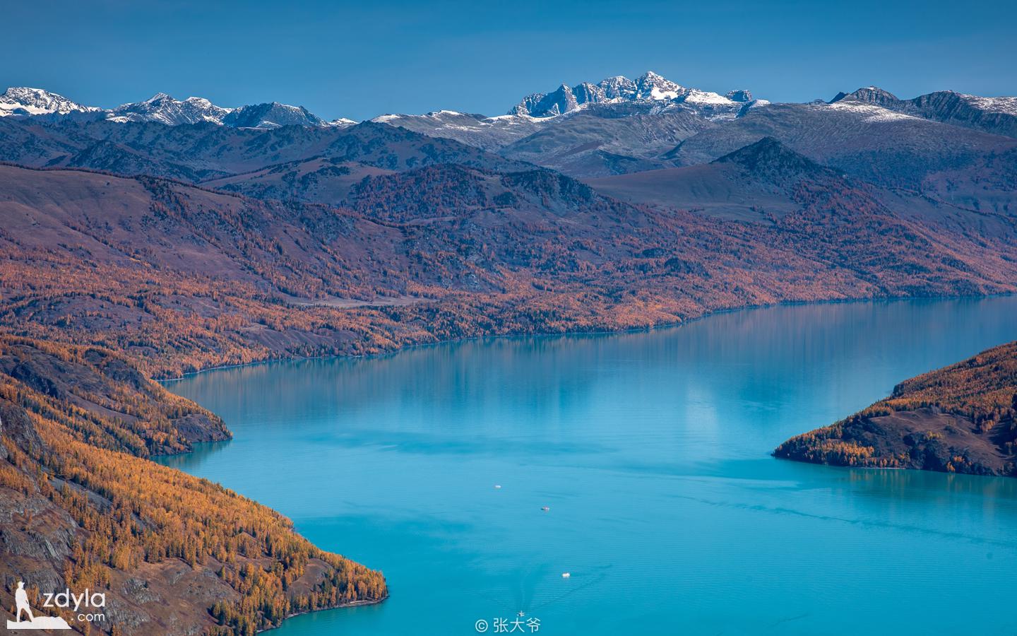
"Kanas" is Mongolian, which means "beautiful and mysterious lake". The snow peak of Kanas Lake stands on the green slope of the ink forest. The scenery of the lake and the mountains is very beautiful. It is known as "the fairyland and the garden of God on earth".
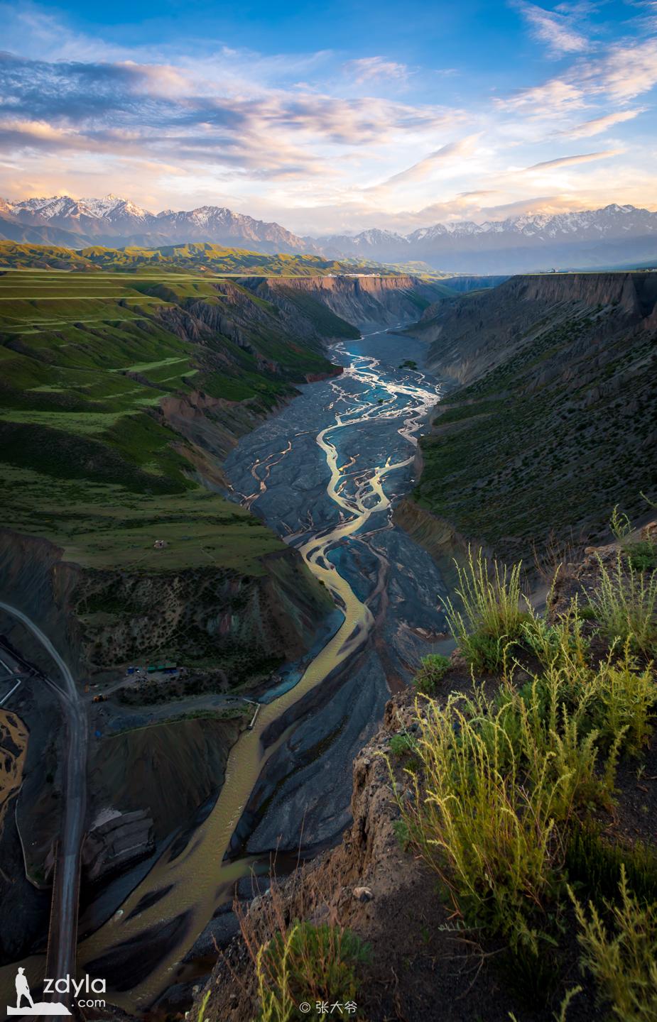
Wolong Bay

Wolong Bay is composed of a series of meandering river bays formed by the long-term lateral erosion of Kanas river. Here, the flow slows down and the water surface floats. In the shape of Omega. There are two Peninsular platforms on both sides of the river bend, and the crescent platform on the river bend. There are two careful beaches in the river, like two huge footprints. It's said that immortals can't resist the temptation of beautiful scenery. They stay when they go down to enjoy the scenery. The downstream is Wolong bay platform, 800 meters long, 450 meters wide, with an area of 36000 square meters. Boarded the side moraine platform 1500 meters above sea level next to the east side of the road, overlooking the panoramic Omega shaped River, just like a jiaolongpan lying in the water, Wolong Bay is named after this.
Moon Bay

Located about 1km upstream of Wolong Bay, Yueliang Bay of Kanas Lake is an extension of the river bend of Wolong Bay. The beautiful and quiet Yueliang Bay will change with the water of Kanas Lake, which is indeed a pearl embedded in the Kanas river. Here, Kanas river bed forms several half crescent River bays composed of anti-s-shaped bends, which are called "Moon Bay". Yueliang Bay twists and turns between the river valleys. The water surface is as smooth as a mirror. There are two small sand beaches which look like footprints in the upper and lower river bays. They are very strange and are called "fairy footprints" by the local people.
The immortal Bay

Shenxian Bay is located in Kanas Scenic Area of Buerjin County, Altay area, Xinjiang. It is a shoal formed in the low and gentle part of Kanas Lake. About 3 kilometers north of Yueliang Bay, there is a river beach. The river here cuts the forest and grassland into small islands, called Shenxian Bay.
Shenzhong Mountain & Zhongshan Canyon
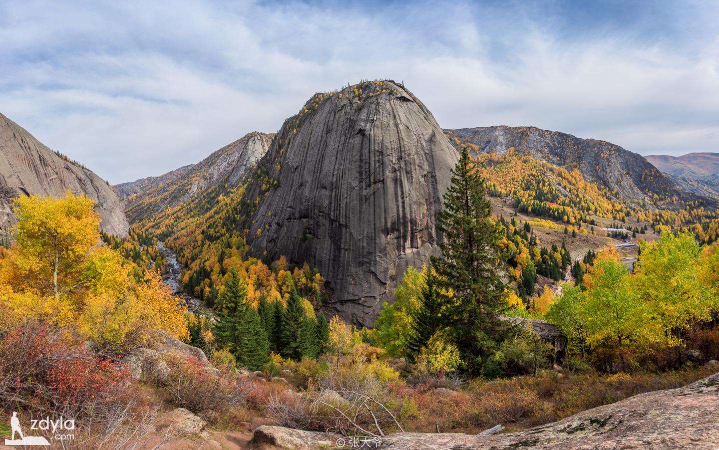
Shenzhong mountain is also called Amir Sala peak. A marvelous and wonderful granite peak with the shape of inverted stone bell rises on the South Bank of the e river, with a relative height of 351 meters. It is the highest in Altai mountain. Shenzhong mountain is like a giant god stepping in between the blue water and the green shade, with blue sky and white clouds on its head, which is majestic, magical and unpredictable. There are birch, pine and Siberian spruce growing on the crack of the rock wall. After the rain, the sky is clear and the rainbow is passing by. The scenery is very spectacular.
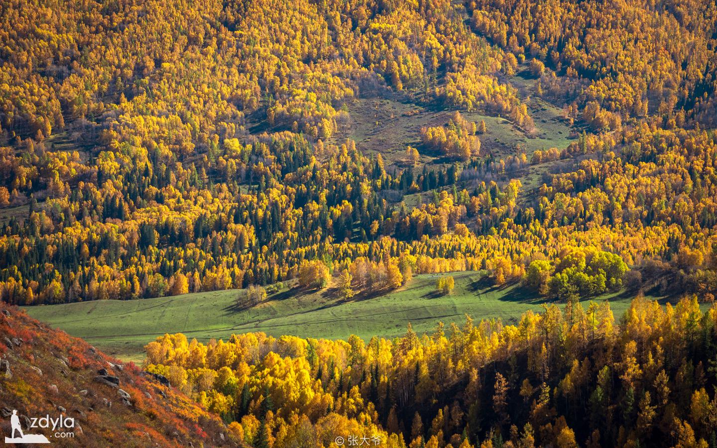
Climb to the top of the mountain and look far away. The peaks are towering. The valley of the ER River leaps into view. The ER river at the foot of the mountain shuttles among the boulders like emerald, bypassing the foot of the bell mountain and leaving. Every autumn, the red leaves on both sides of Shenzhong mountain canyon dye the whole Canyon red. Autumn is full of interest. It is a northern scenery, just like the middle of the painting.
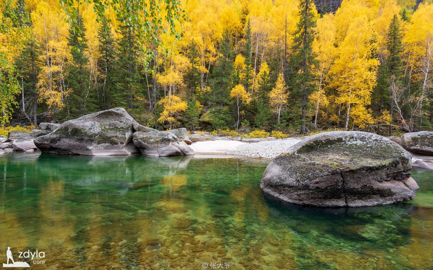
Betula platyphylla forest

Betula platyphylla forest grows in the Bay on the convex bank of Erqis River, covering an area of 1.5 square kilometers. It is composed of three Betula islets of different sizes. It is dominated by Betula platyphylla, followed by Populus Siberia, which is a secondary broad-leaved forest in the cold temperate mountains.
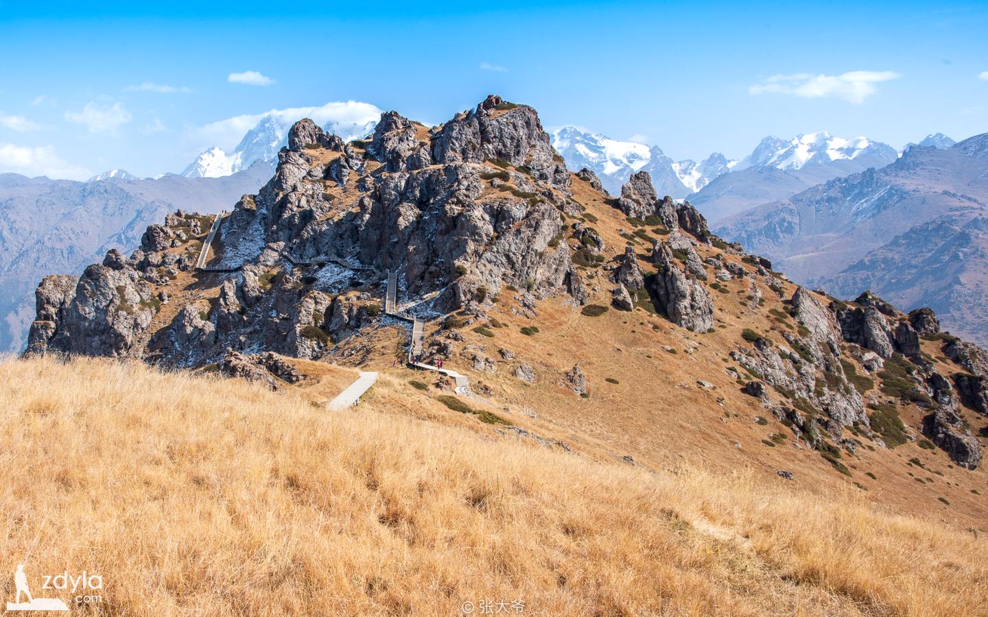
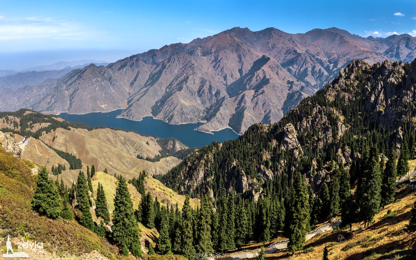
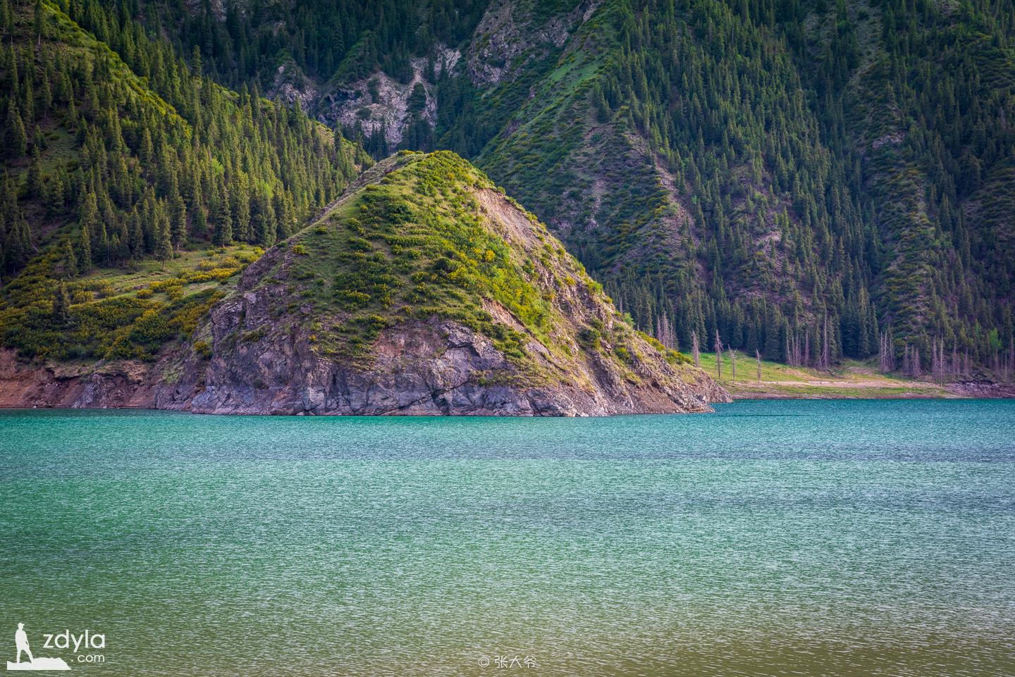
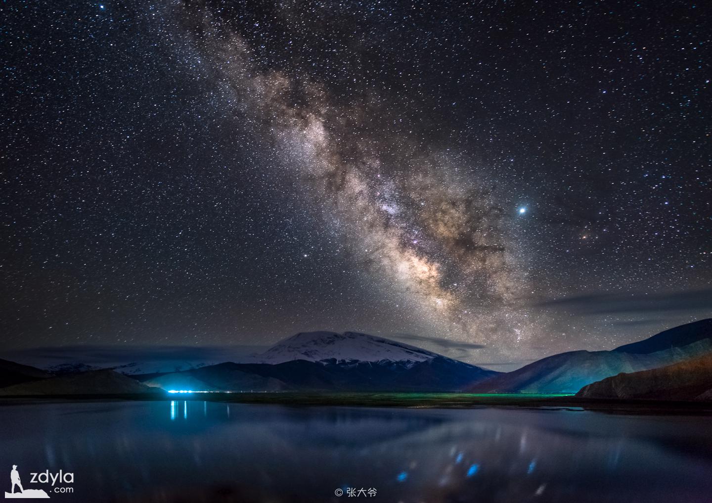
Tianshan Tianchi
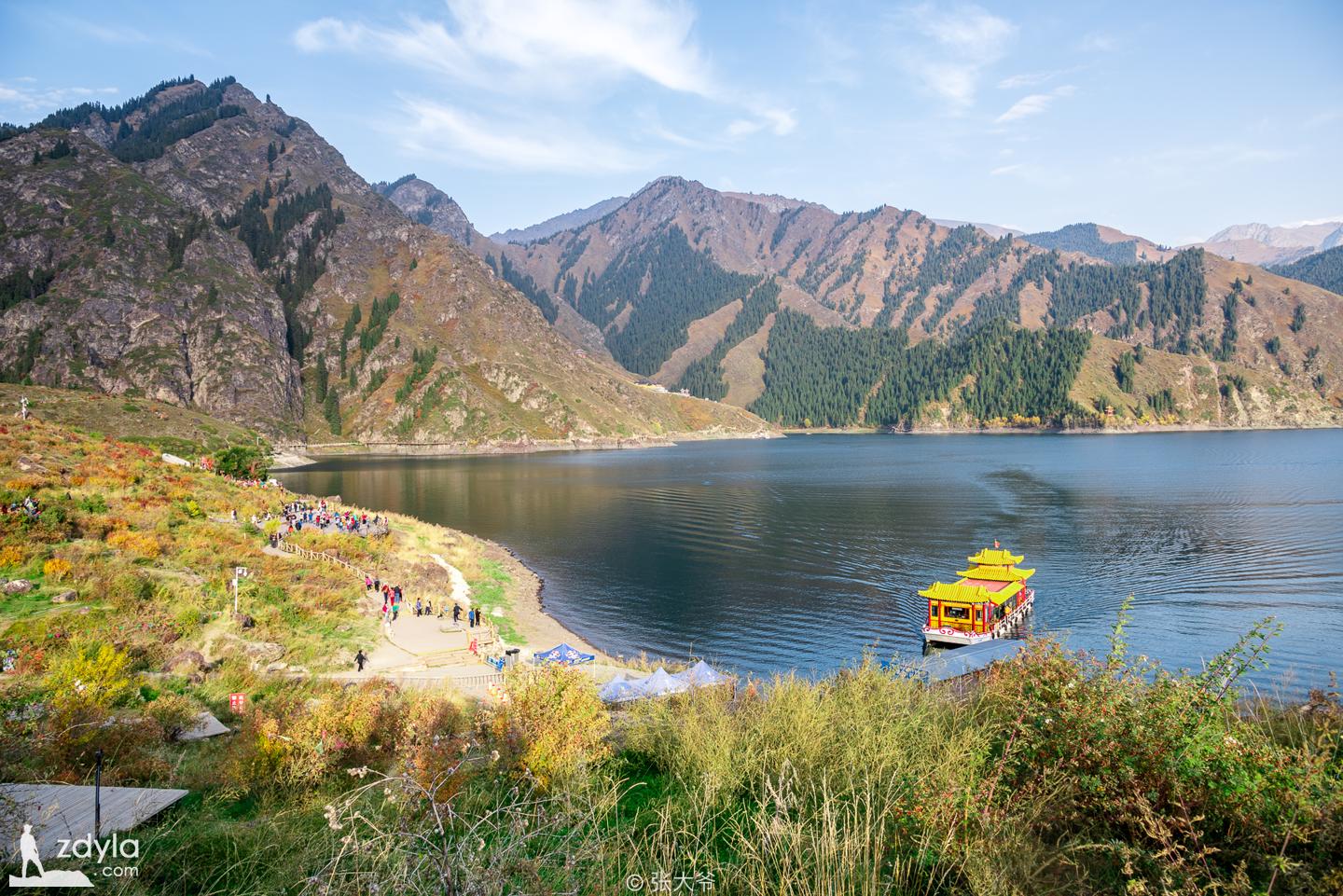
Tianshan Tianchi scenic area is centered on Tianchi, including four complete mountain vertical natural landscape zones, covering a total area of 380.69 square kilometers. Tianchi Lake is a half moon shaped lake with a length of 3400 meters, a width of 1500 meters, an area of 4.9 square kilometers and a depth of 105 meters. The lake is clear and crystal clear. Surrounded by mountains, green grass and brocade flowers, it is known as the "Pearl of Tianshan Mountain". Tall and straight, green spruce, tasong, diffuse mountains and mountains, block out the sun.
To the southeast of Tianchi is the majestic main peak of Bogda (Mongolian "Bogda", which means Lingshan and Shengshan) with an altitude of 5445 meters. There are two peaks connected to each other. Looking up from afar, three peaks rise together, abruptly inserted into the clouds, like a penholder.
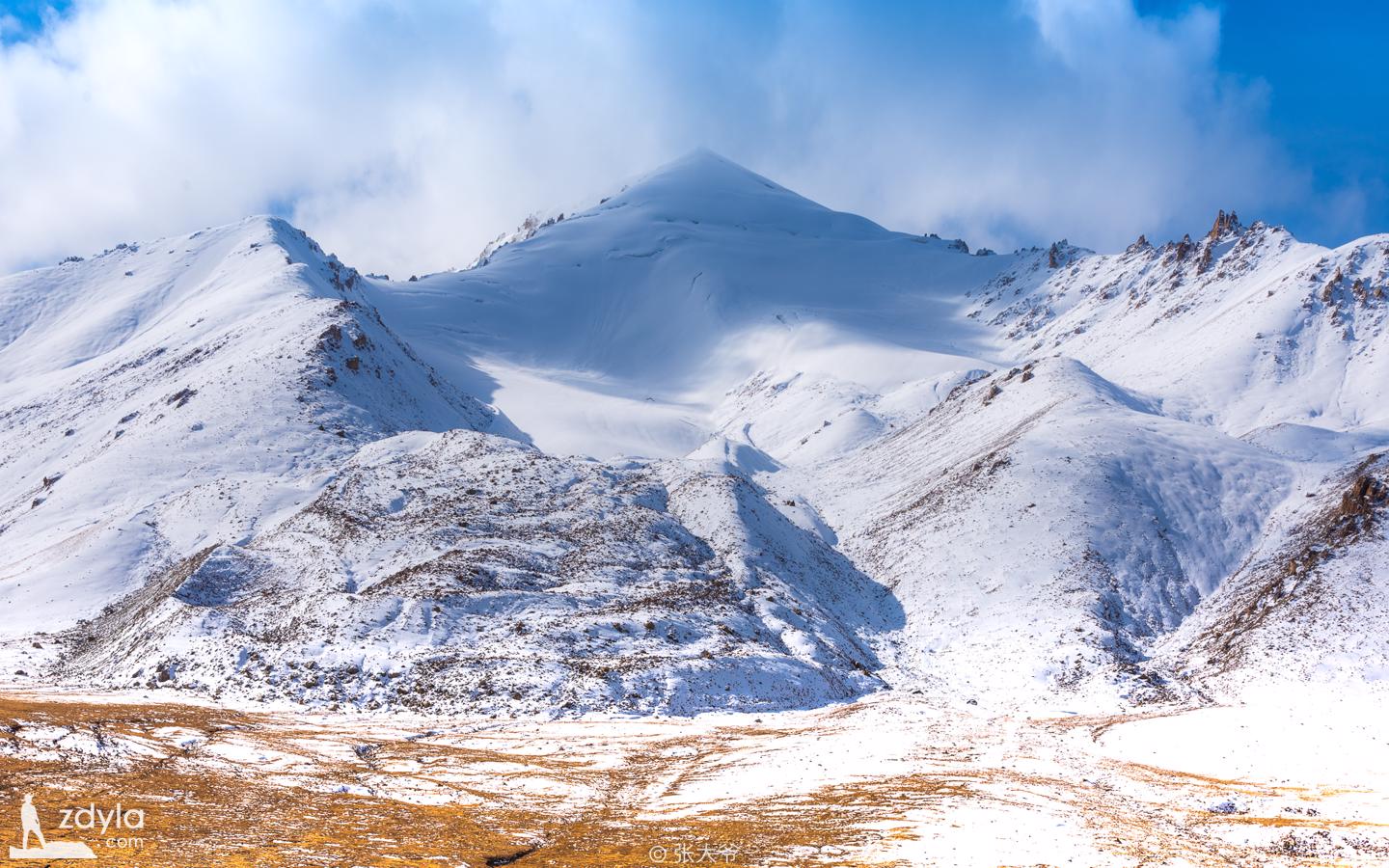
Horse tooth mountain
Maya mountain is 4.5km southwest of Dahaizi, Tianchi, with an altitude of 3056m and a tourist area of 0.5km2. The peak is steep and upright, straight into the sky, like a row of huge horse teeth, so it is named. It's carved by rows of ancient glaciers. On the north side of the mountain and the edge of the forest, there is a pillar like stone forest formed by the weathering and water erosion of the pillar like eruption rock, which has a very beautiful shape. It is the best rock in the Tianchi scenic area formed by ice sculpture.
The great sea
Dahaido is the nearest road between Dunhuang Hami Turpan in ancient times. Its opening and use began in the Han Dynasty. After the Tang Dynasty, the official use tended to stop, and the great Haidao gradually faded out of people's vision, becoming the ancient Silk Road in historical memory. The Silk Road, as a channel of ancient communication between Chinese and Western civilization, has been concerned by the academic circles for its great role in the history of human civilization communication. With the deepening of academic research, most sections of the silk road have been gradually unveiled, but the specific route of dahaido is still buried in the historical dust.
Flaming Mountains
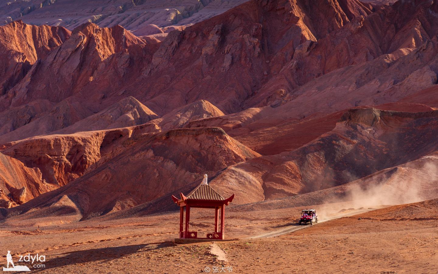
Huoyanshan, formerly known as chishi mountain, is located in the northern edge of Turpan Basin and the North Road of the ancient Silk Road. East West trend. Huoyanshan, which is called "kiziltag" in Uyghur, means "Hongshan". It was once called "Volcano" in Tang Dynasty because of its heat. The mountain is more than 100 kilometers long, the widest part is 10 kilometers, the altitude is about 500 meters, and the main peak is 831.7 meters above sea level. Huohuo mountain is barren, with no grass and no birds. When the hot summer comes, the red sun is in the sky, and the reddish brown mountains are illuminated by the hot sun, the sandstone is burning and shining, and the hot air flow is rolling up, just like the fire is raging, and the tongue of the fire is touching the sky, so it is also called the flame mountain.
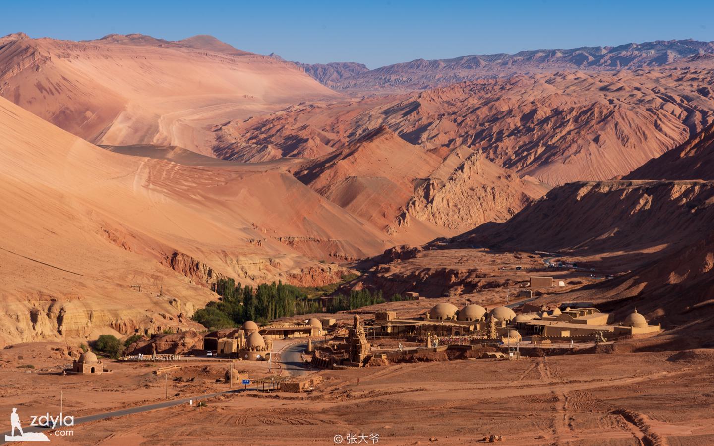
Mazha village, tuyugou
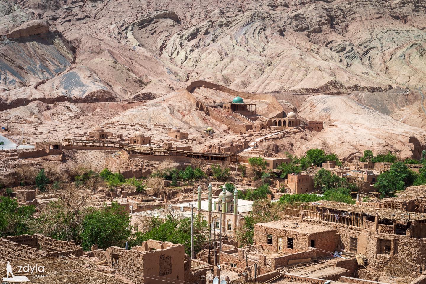
Tuyugou Mazha village is a typical representative of the village pattern under the background of Islamic culture in the east of Xinjiang. It has important material significance to study the formation and development of Islamic culture and arid and rainless desert oasis culture. In Mazha village, there are a large number of traditional Uyghur dwellings, all of which are made of yellow clay soil, all of which are civil structures, some of which are caves, some of which are two-story buildings, some of which are dug according to the mountains and slopes, some of which are made of yellow clay soil. According to the local natural environment and survival needs, the ancestors of Mazha village made houses out of yellow clay and adapted to local conditions. They are a well preserved group of native buildings in China and can be called "the first native village in China".
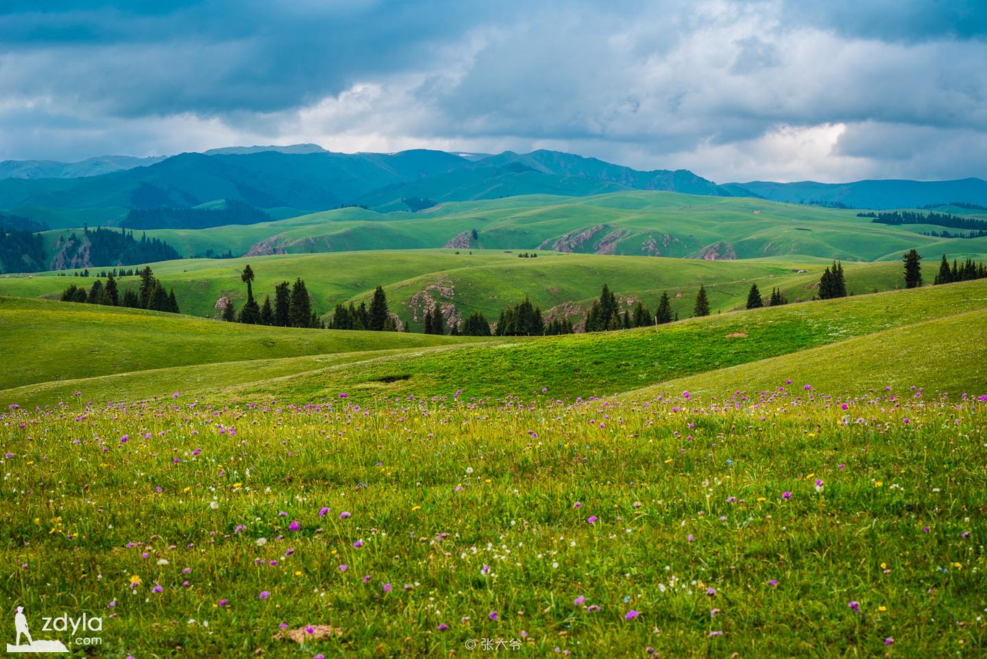
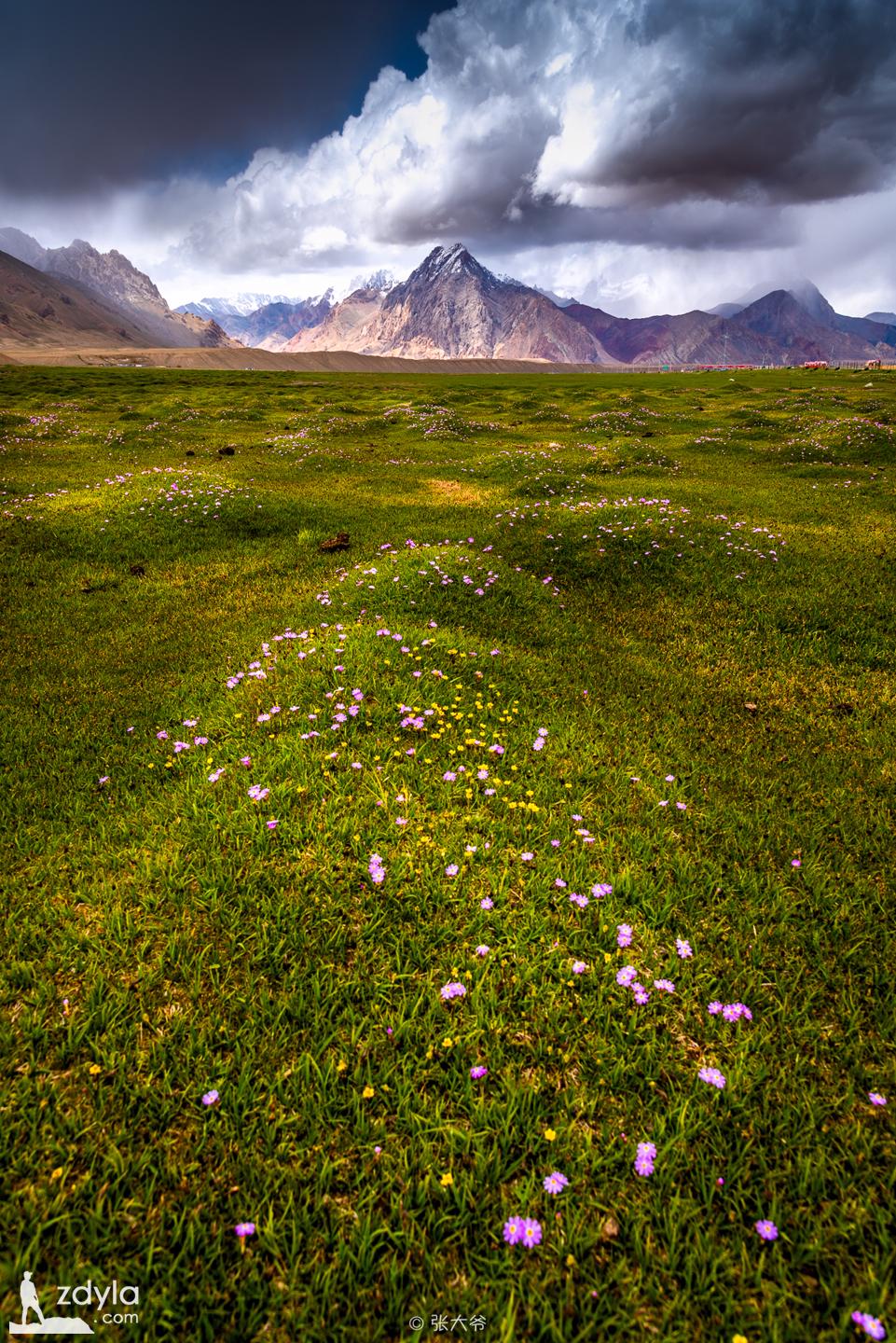
Nalati grassland
Nalati grassland is also known as (West) Gongnaisi grassland. In the language of Wara Mongolia, it means "Green Valley" (in Yuan and Ming and Qing Dynasties, this is the pastoral area of Wala huite), and in the language of Kazak, it means "baiyangpo". In the east of Nalati Town, Xinyuan County, Ili Prefecture, Xinjiang, it is about 110 kilometers away from Xinyuan county. It is located in the north slope of Nalati mountain. It is a Zhongshan grassland developed on the paleodiluvium of the tertiary.
Karajun grassland
"Karajun" is a Kazakh language. It means dark, rich and vast. "Jun" describes the dense appearance. Literally, "karajun prairie" can be translated into the vast grassland. It is located in Tekes County, Ili River Valley, Xinjiang. It is the transition zone from the West Tianshan Mountain to Ili River Valley. It has abundant rainfall, cool climate and thick soil, which is very suitable for the growth of herbage. There are hundreds of high-quality herbage.
Actas grassland
Ili also has an unknown grassland with beautiful scenery, which is comparable to the karajun grassland. At the south foot of Wusun mountain, to the west of Tekes Daban, there is a ridge grassland, which is the grassland of aketas animal husbandry village, Tekes Town, Tekes County, and also the "aketas Grassland".
In May, the aketas prairie in tex county is rich in water and grass, with all kinds of wild flowers in full bloom, making people seem to enter the green ocean
Jonkushtai Village
According to the local natural environment and survival needs, the ancestors of qiongkushitai village took local materials and built houses with wood, forming this unique village. Due to the hard and durable wood of pine and fir trees, the local wooden structure has no deformation and long service life. In addition, it is located in the depth of the mountain, with inconvenient transportation, and each household carefully protects its own houses. Therefore, a large number of houses in the village are well preserved, some of which have a history of more than 100 years and have rich and complete historical and cultural connotations. From the perspective of wood structure building as the residential building of Kazak herdsmen in qiongkushitai village, this is undoubtedly the evolution of herdsmen from the mobile living style to the permanent living style. At present, there are still many wooden houses with Kazakh nomadic characteristics in the 1950s and 1960s.
Sayram Lake
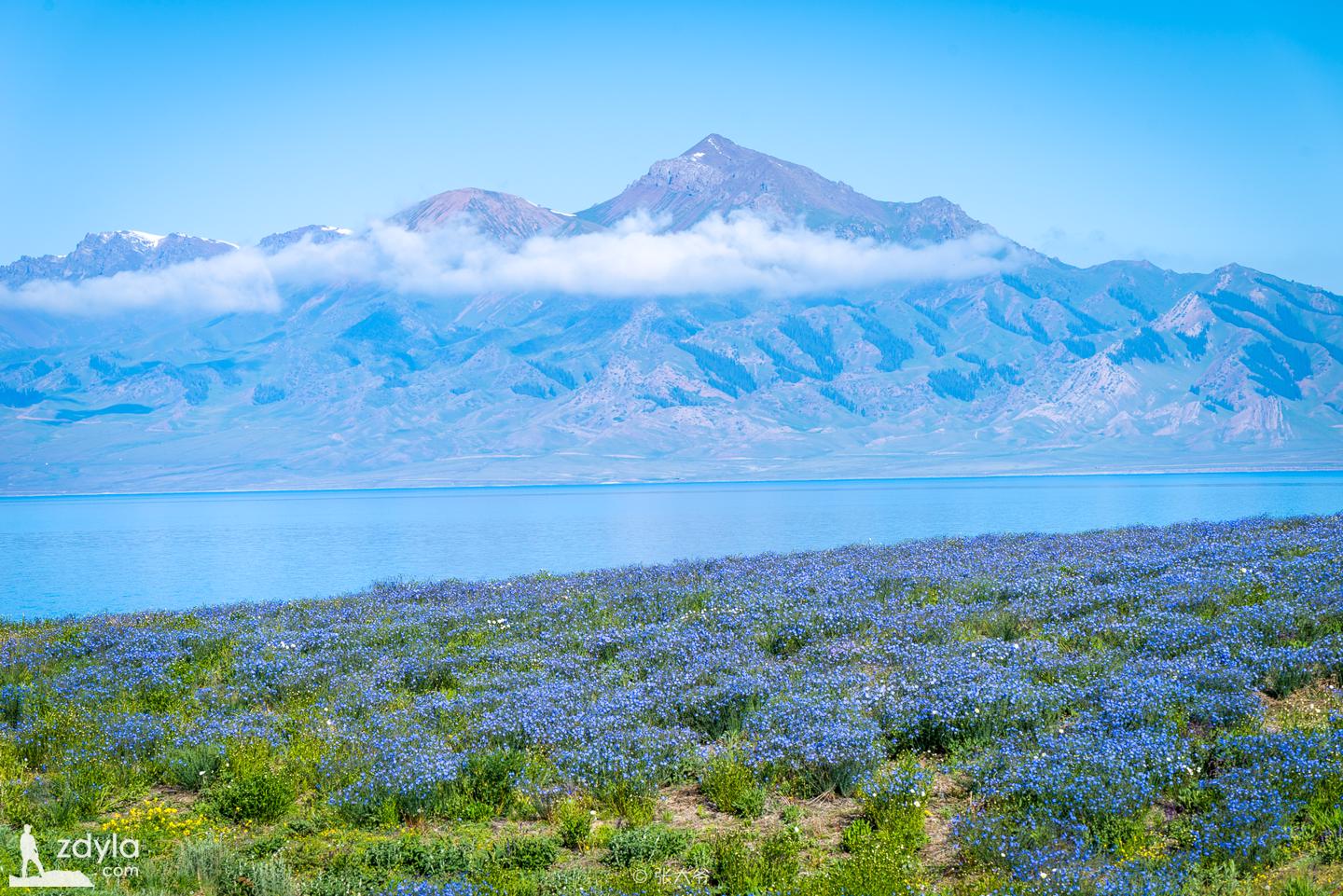
Sailimu Lake, known as "Jinghai" in ancient times, is located in the Northern Tianshan Mountains in Bole City, Bortala Prefecture, Xinjiang. It is close to Huocheng County, Ili Prefecture. The lake is 2071 meters above sea level, 30 kilometers long from east to west, 25 kilometers wide from south to north, 453 square kilometers in area, with a water storage capacity of 21 billion cubic meters. The lake is clear and transparent with a transparency of 12 meters. It is a mountain lake with the highest altitude, the largest area and beautiful scenery in Xinjiang. It is also the last place favored by the warm and humid air of the Atlantic Ocean. Therefore, there is the saying of "the last tear of the Atlantic Ocean".
Guozigou Bridge
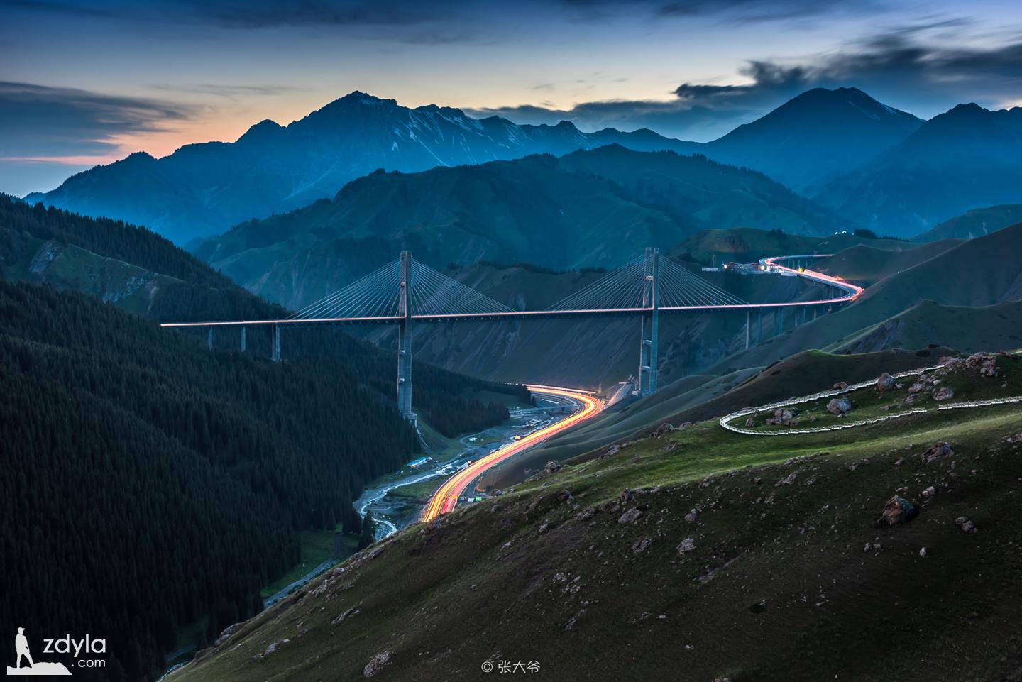
As the first cable-stayed bridge and the first high-rise bridge in Xinjiang, Shizigou bridge is the largest and most important bridge in Xinjiang, as well as the first highway steel truss girder cable-stayed bridge in China. It integrates new technology, new structure, new technology and new equipment, and is a major breakthrough in the history of highway construction in Xinjiang. The completion of the bridge has become a magnificent scenic spot in the fruit valley.
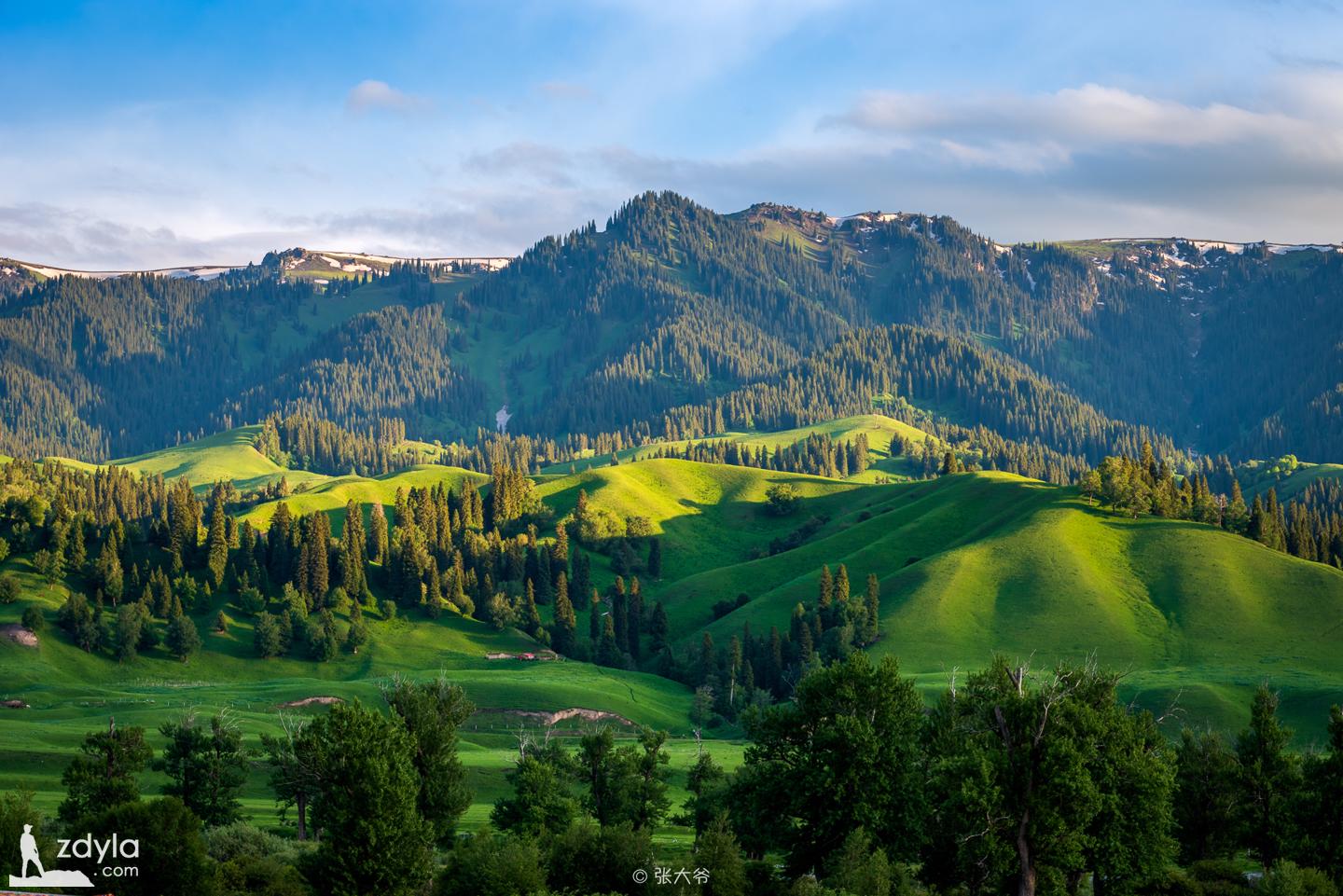
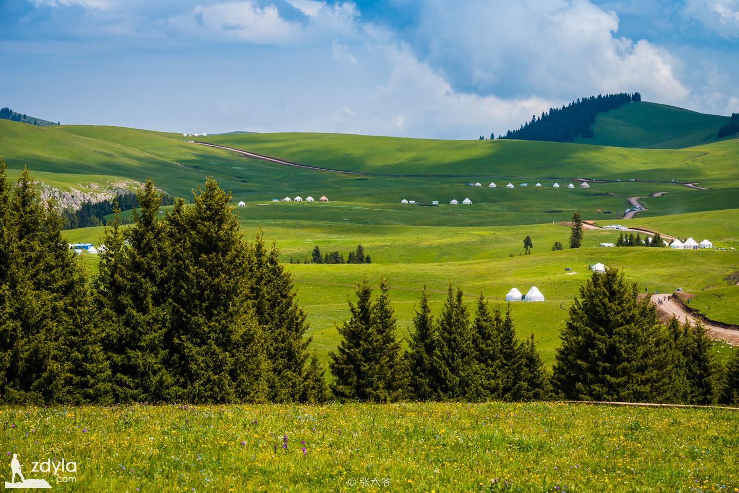
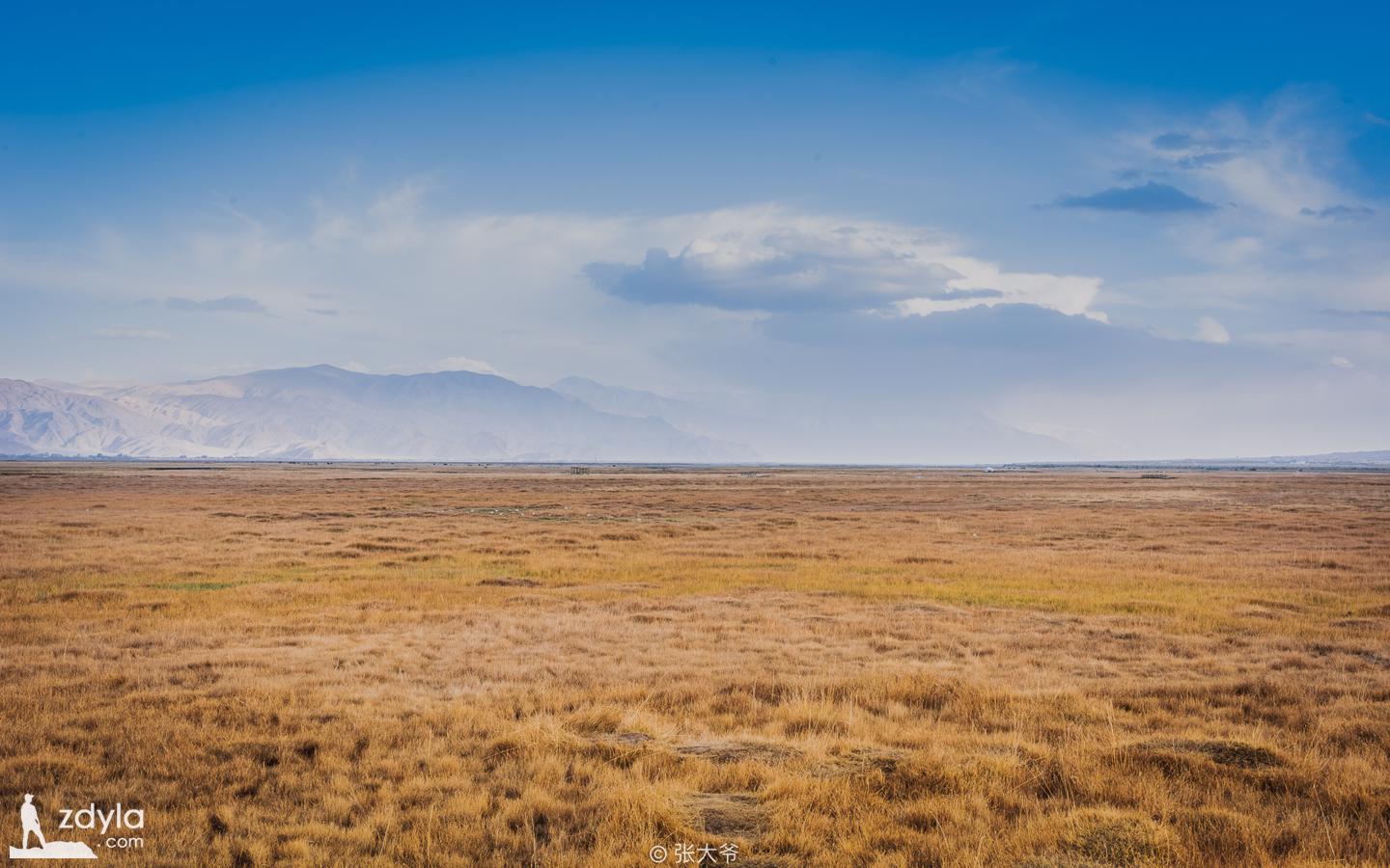
Bayinbrook prairie

Bayinbrook grassland was formerly known as yuludus grassland, zhuludus grassland and yuludus grassland, because it is mainly located in bayinbrook District in the northwest of Bayingolin Mongol Autonomous Prefecture and Jingxian County of Xinjiang Uygur Autonomous Region, also known as bayinbrook grassland, in yuludus River region.
It is a basin between mountains in the middle of the Tianshan Mountains, surrounded by snow mountains, with an altitude of about 2500 meters and an area of 23835 square kilometers. It is the abundant spring in Bayinbuluk Mongolian meaning - "abundant spring". The grassland is flat and rich in water and grass. It is a typical grass meadow grassland and one of the most important animal husbandry bases in Xinjiang. There are not only Xanadu surrounded by snow mountains, Kaidu River with nine curves and eighteen bends, but also Swan Lake with elegant charm.
Hashilgen Pass Area


The zigzag and spectacular Duku road passes through the hashilgendaban tunnel, 3390 meters above sea level in Tianshan Mountain. It used to be the highest tunnel in China. There is also a 100m long snow proof corridor built on the road, which can make the avalanche on the cliff fall into the deep ditch beside the road, which is a unique scene.
Dushanzi Grand Canyon
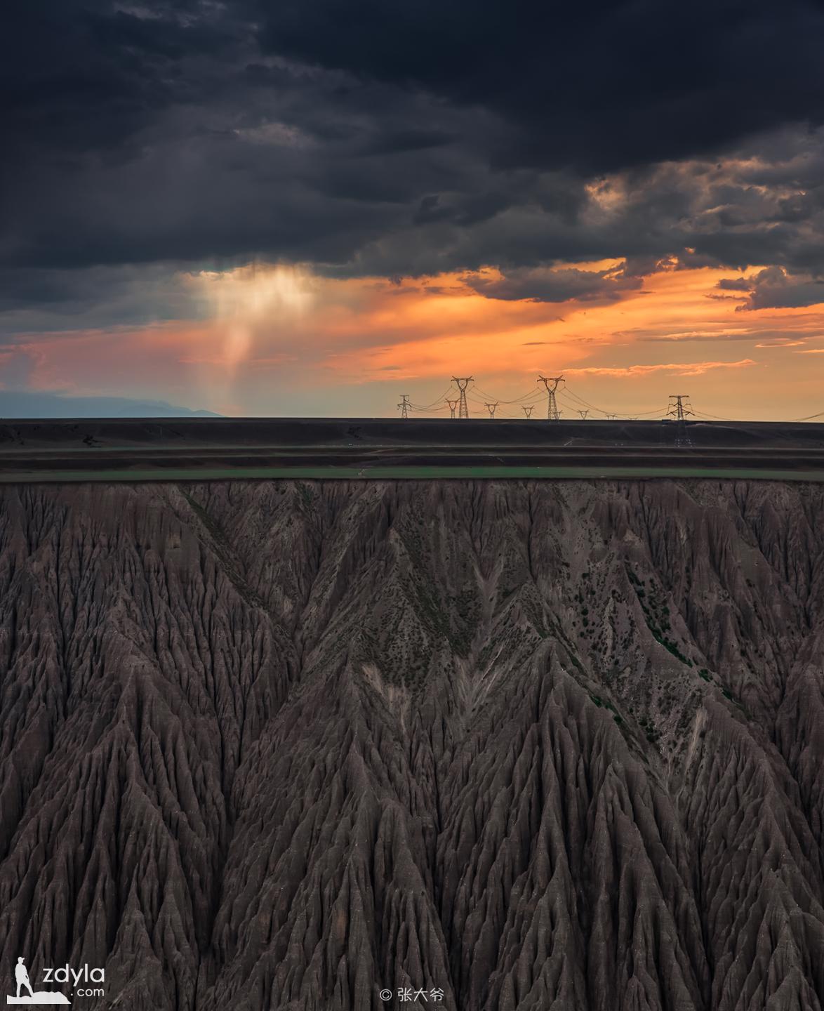
In Dushanzi, the Kuitun River passes through Dushanzi Grand Canyon and the canyon is nearly north-south oriented. The ancient coin cliff of the canyon is steep, and the bottom of the valley is flowing at the same time. The ground on the shoulder of the valley is desert grassland. Standing on the shoulder of the valley and looking at the canyon, what you see is a typical Grand Canyon scene. The snow water and rain water from Tianshan Mountain flow down the alluvial gullies formed by the soil here, carving out these peculiar landscapes on the valley wall.
AnJiHai Grand Canyon
The AnJiHai river originates from the Tianshan Mountains. Through years of scouring, it has rushed out of the Tianshan valley near tonggute, forming a large-scale impact fan under the northern slope of Tianshan Mountain. The impact fan of the river valley has a large scale and opens northward in the shape of an umbrella, which is called a geological spectacle.
It's not a scenic spot. Locals don't know much about it. There are almost no tourists. It's dangerous to shoot. Standing at the top of the mountain and looking at the bottom of the valley, your back is cool.
Big dragon pond
Xiaolong pool

Starting from Kuqa in Xinjiang and traveling 120 kilometers north along Tianshan Road, there are two alpine lakes, commonly known as dalongchi and xiaolongchi.
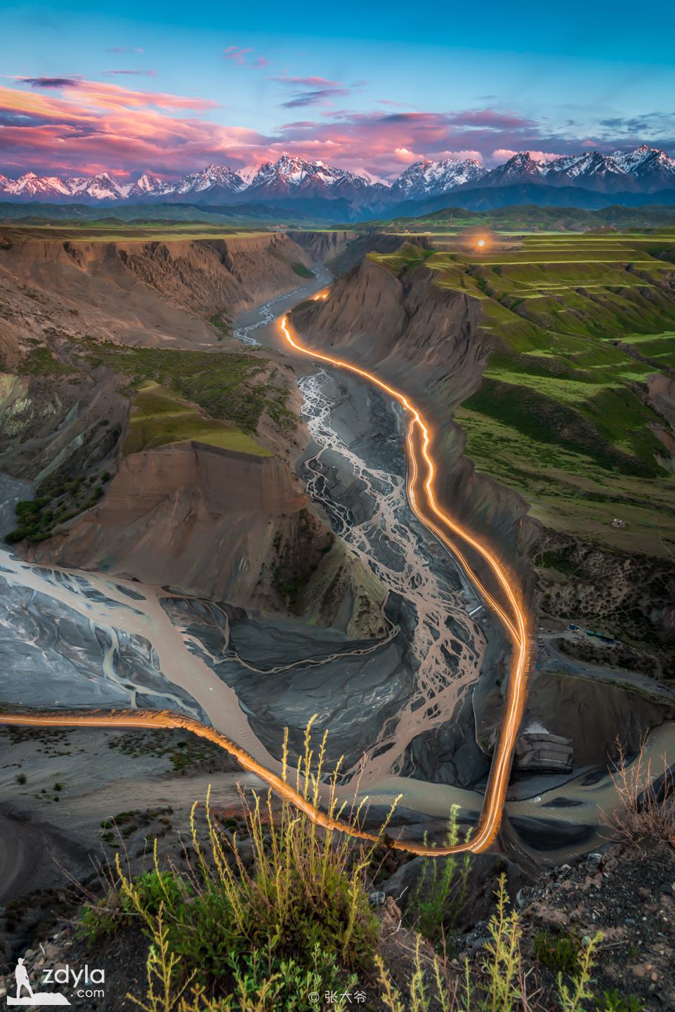
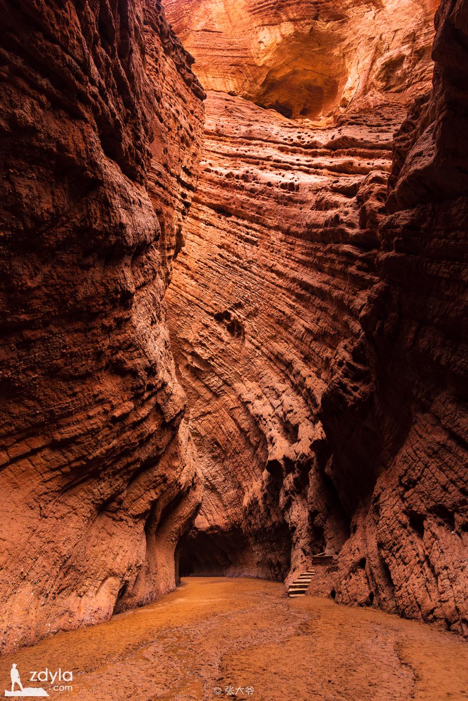
Kuqa Grand Canyon

Kuqa Grand Canyon is composed of a huge group of red brown mountains, which is called "kizilia" (red cliff) in Uygur language. It is actually formed by hundreds of millions of years of wind and rain erosion and mountain torrents. The Grand Canyon is approximately in a north-south arc direction. The opening slightly bends to the southeast, and the end slightly bends to the northeast. It is composed of the main Valley and seven branch valleys, with a total length of more than 5000 meters.
Tianshan Mysterious Grand Canyon
The formation of the Mysterious Grand Canyon in Tianshan occurred about 200 million years ago. During this period, the earth's crust changed dramatically. The earth's crust in this area rose or fell repeatedly, showing obvious sedimentary cycles and lithofacies changes.
Hongshan Stone Forest
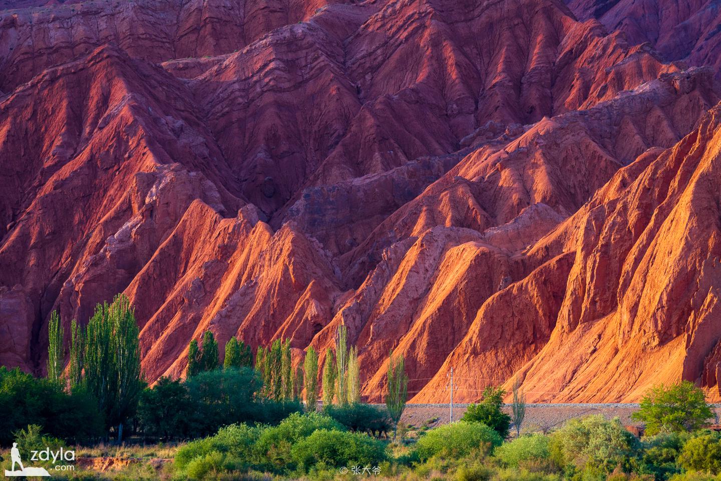
Hongshan stone forest is 66 kilometers to the north of Kuqa County and the west of national highway 217. The mountains are red in color. The upright monoclinic rocks formed by the orogeny of the original seafloor rocks form a layered "stone forest", which is spectacular. They are scattered with the mountains of different colors nearby, and complement each other, forming a wonder of Tianshan Mountain.
Old town of Kuqa
Kuqa is one of the important political, economic and cultural towns in Western China since the Han and Tang Dynasties. There are rich cultural heritage, intangible cultural heritage and natural heritage in the territory, which is a historical witness of the harmonious unity of multi-ethnic countries since ancient times.
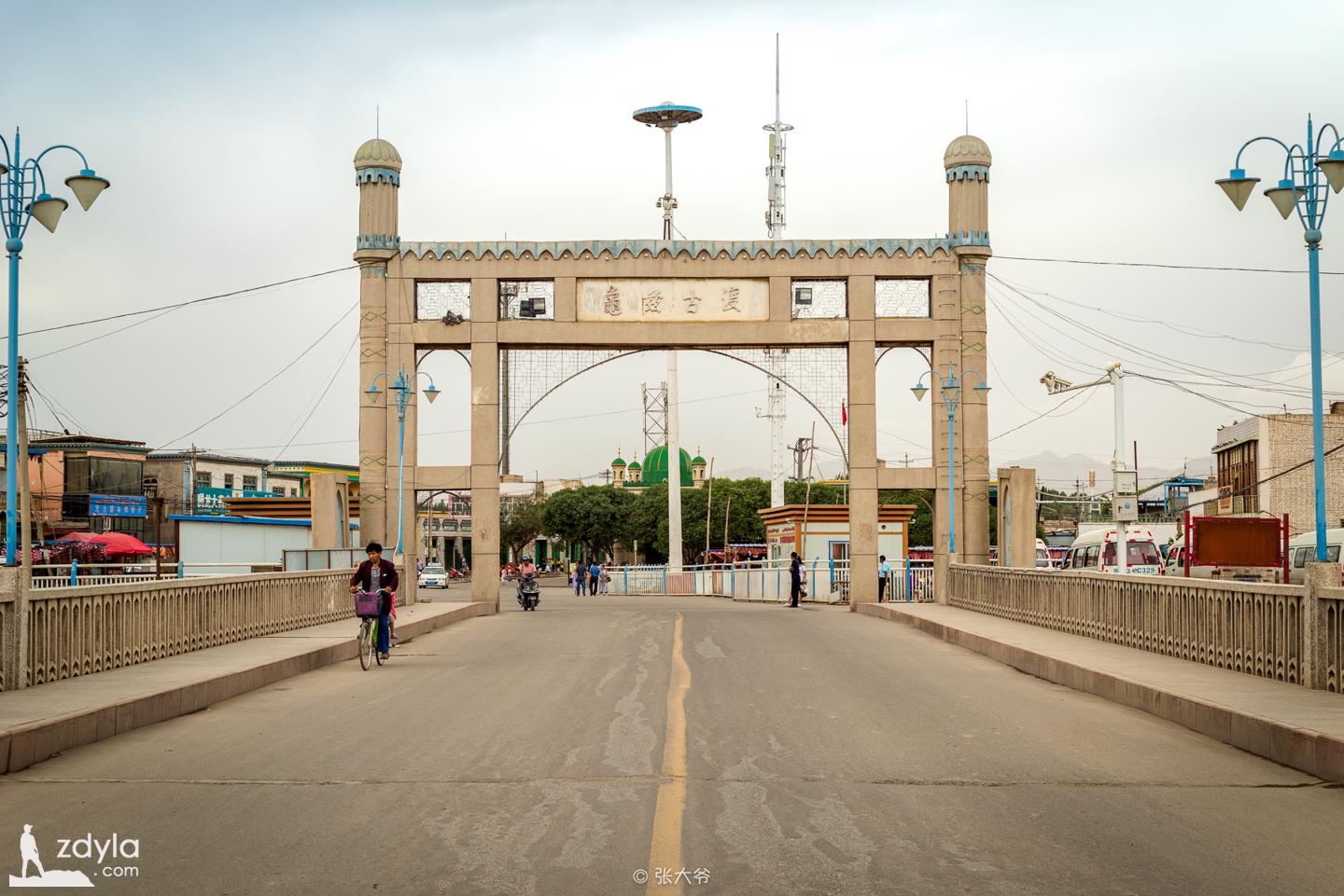
Old Kashgar City
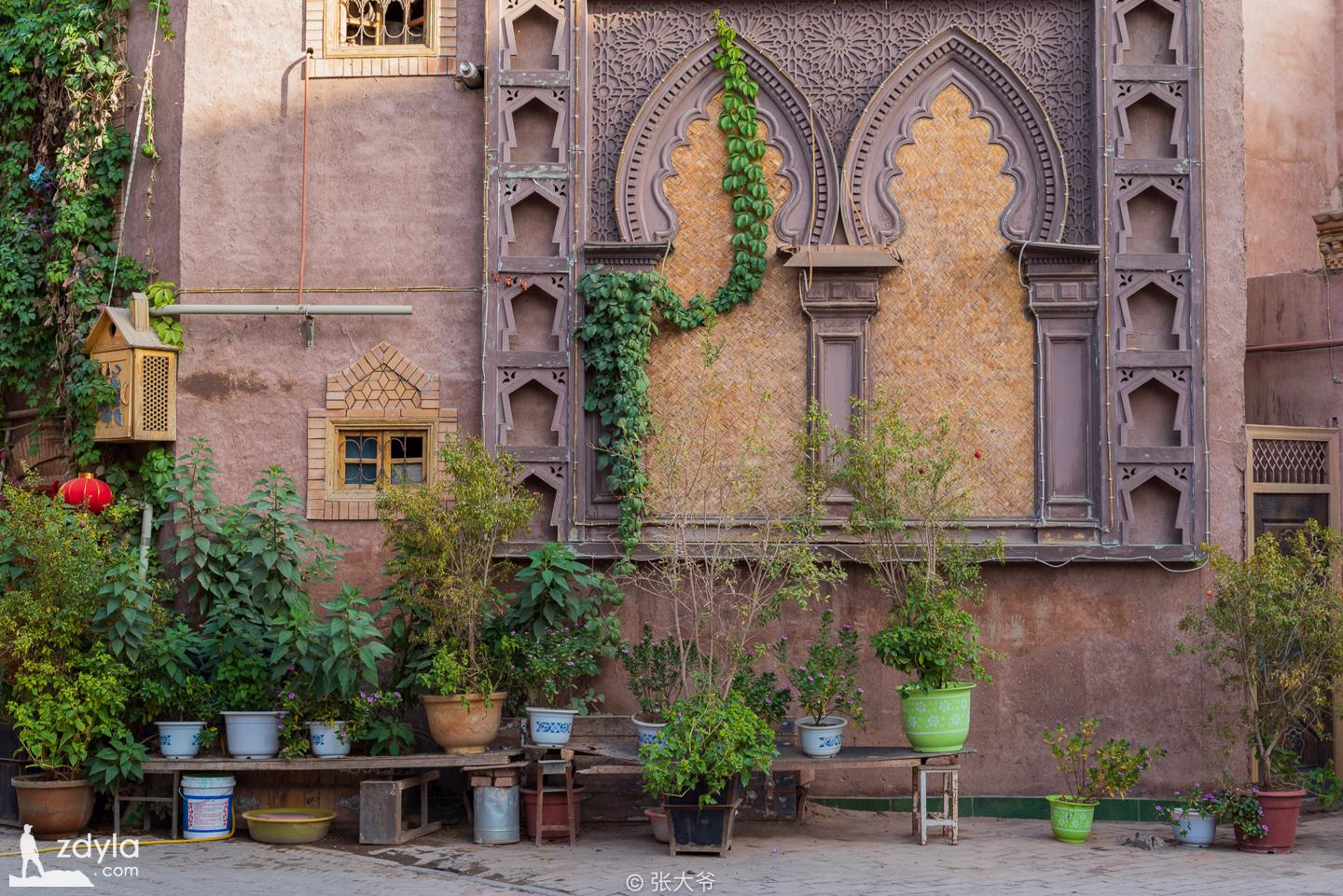
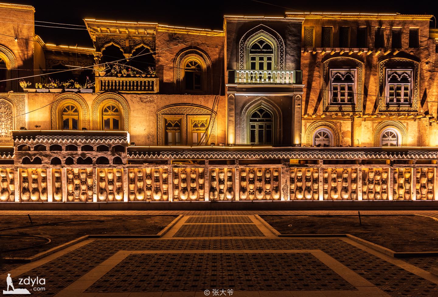
The old urban area of Kashi City in Xinjiang is like a living animation of Xinjiang Uygur folk customs. The old urban area of Kashgar is located in the center of Kashgar, with an area of 4.25 square kilometers and about 126800 residents. The streets and lanes of the old city are crisscross, the layout is flexible and changeable, and the winding roads are secluded. Most of the dwellings are civil and brick wood structures. Many of the traditional dwellings have a history of hundreds of years, and they are the only labyrinth urban block with Islamic culture as its characteristics in China.
Gaotai residence
The Uyghur people living in Gaotai dwellings have lived together for generations. The houses are built along the cliffs, and the family population has increased for a generation, so they build a floor on the houses of their ancestors. In such a generation, the houses are connected with houses, the buildings are connected with buildings, and the layers are stacked. Most of these houses are earth houses, and there are many new brick houses. More than 50 alleys have been formed between these randomly built upper and outer buildings, which are in all directions, crisscross, zigzag, up and down. Without local people leading the way, outsiders will surely get lost.
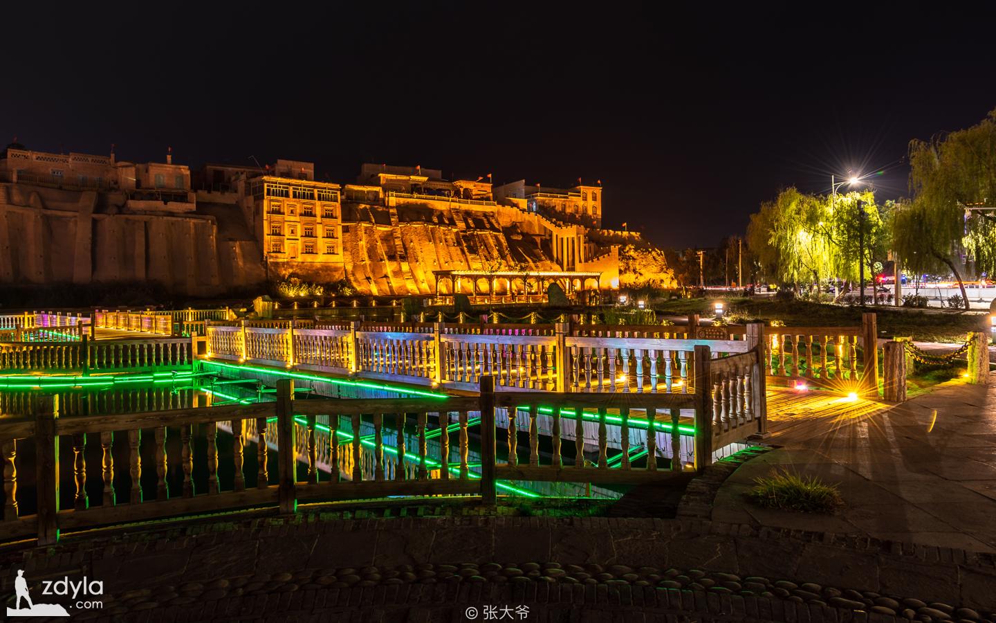
Kashi East Lake Park
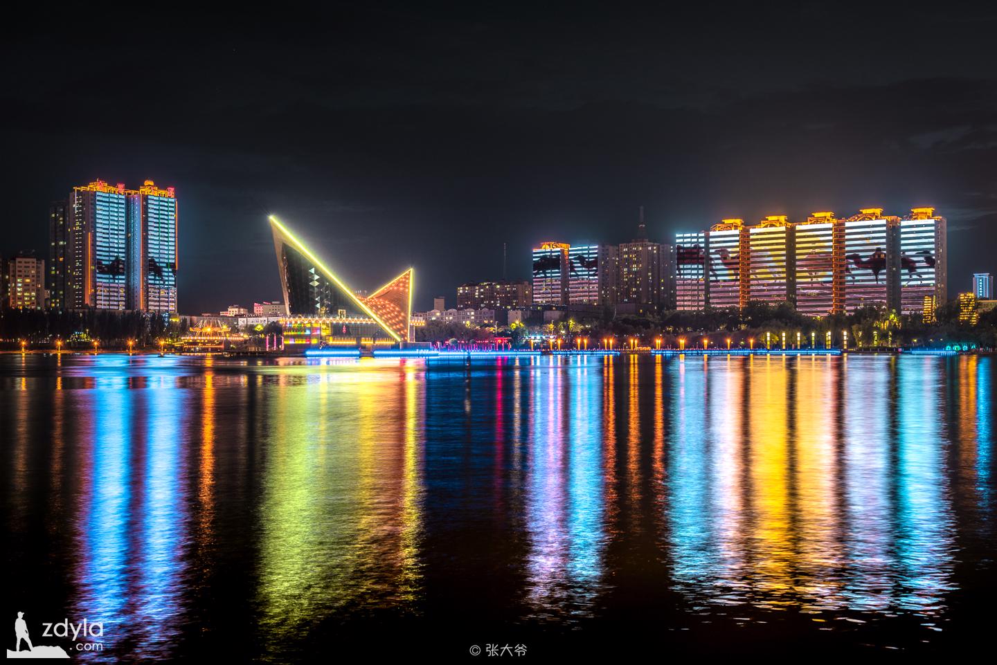
Kashi East Lake Park is located on the central axis of the light belt of the Tuman River in the city. It was built in the spring of 1977. It is an artificial lake in the city. Its night scene is particularly beautiful and worth visiting.
Baisha lake, Baisha mountain
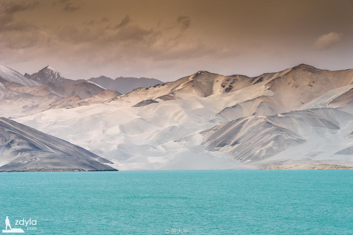
Baisha mountain is located in the Pamir Plateau mountains of Kashgar, Xinjiang. It is the only place to go to karakori lake. Kashgar is about 150 kilometers westward to the Pamir Plateau. Lake Clarke, also known as Baisha lake, is a plateau lake with an area of 44 square kilometers. On both sides of Baisha Lake stands Gonger jiubiefeng. Such beautiful scenery makes the snow mountain and lake seem more pure and quiet after sleeping for thousands of years. It is said that Liusha River described in journey to the west is here.
Karakuli Lake
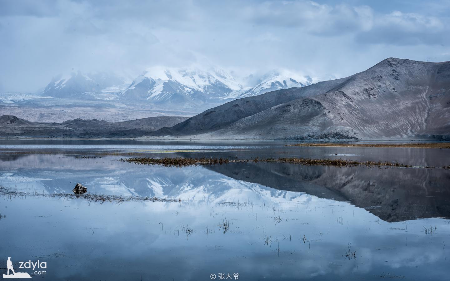
Karakuli lake is 220 kilometers away from Atush, located between Gongge peak, Jiuge Jiubie peak and mostag peak, which is a high mountain lake. With an altitude of 3600 meters, an area of 10 square kilometers and a water depth of more than 30 meters, the lake is named "Karakul" (Kirgiz means Black Lake) because of its deep and gloomy water.
Mostag peak
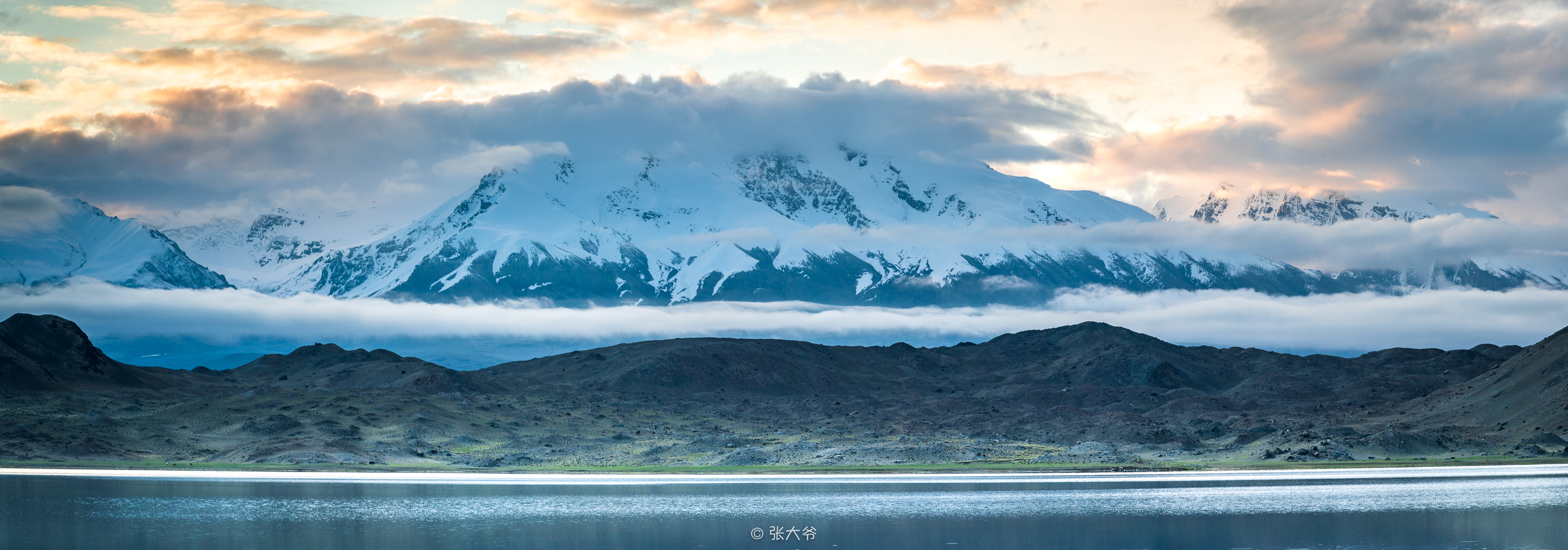
Mt. mostag belongs to the Kunlun Mountains and is the third highest peak in the West Kunlun Mountains. Mount mostag, mount Gonger and mount Gonger jiubiefeng stand like giant jade pillars on the beautiful Pamirs Plateau and become the symbol and representative of the Pamirs plateau.
Gonger mountain
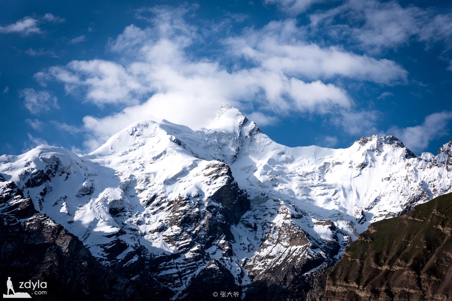
Gonger mountain is Gonger peak. Gonger peak, with an altitude of 7649 meters (also known as 7719 meters), is one of the world famous peaks. Gongger peak is located in aketao County, Xinjiang Uygur Autonomous Region, China. It belongs to the Kunlun Mountains and is the highest peak of the Kunlun Mountains.
Gongger peak is a pyramid shaped mountain, almost all of which are made of rocks and ice and snow. In Kirgiz (Kyrgyz), Gongge means "brown mountain". It is said that the difficulty of conquering Gongge peak is no less than Mount Everest. It wasn't until 1981 that the British mountaineering team reached the summit of Gonger peak from the south slope for the first time. Its north slope is particularly dangerous, so far no one has climbed the peak from the north slope.
Alarkin grassland
Alaerjin grassland is located in the east of Tashkurgan County, on both sides of Tashkurgan River, covering an area of 20 square kilometers, and is a wetland on the Pamirs plateau.
Khunjerab
The best description of hongqilap is that "snow accumulates in Wanshan mountain and snow covers Wanshan mountain".

It is said that before monk Tang took scriptures in the west, a caravan of up to ten thousand people died in a snowstorm. Up to now, there are still people who have been searching for the treasures discarded by the caravan.
Zal
The big colored eggs on the Karakoram Road, I didn't expect that there is such an excellent grassland on the plateau. On the broad pasture, there is only a hill full of flowers, like the green dwarf living in the mountains, interesting and lovely
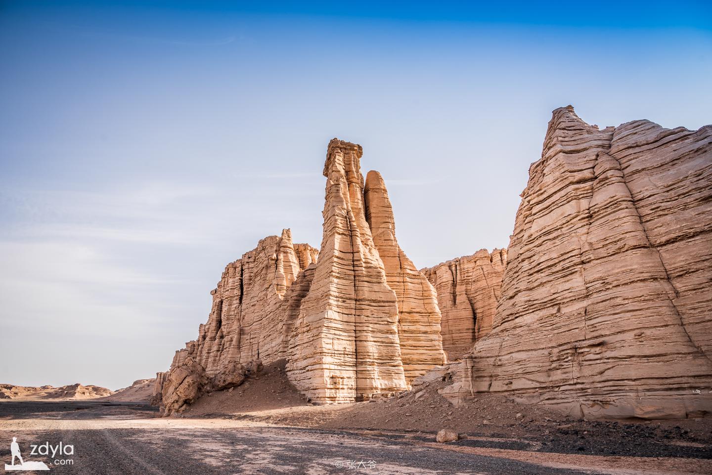
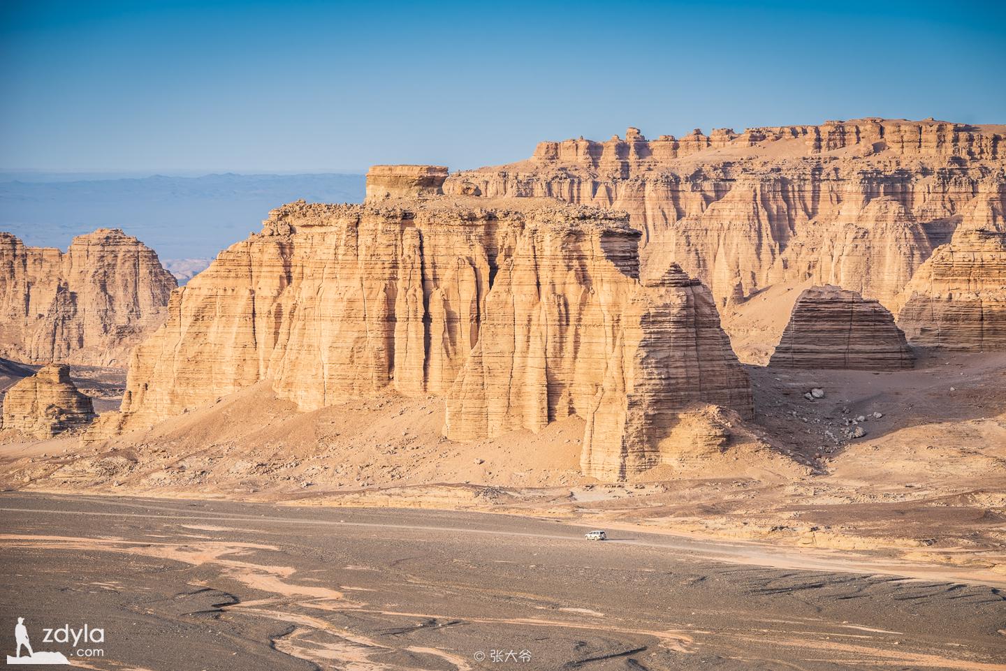
Desert road
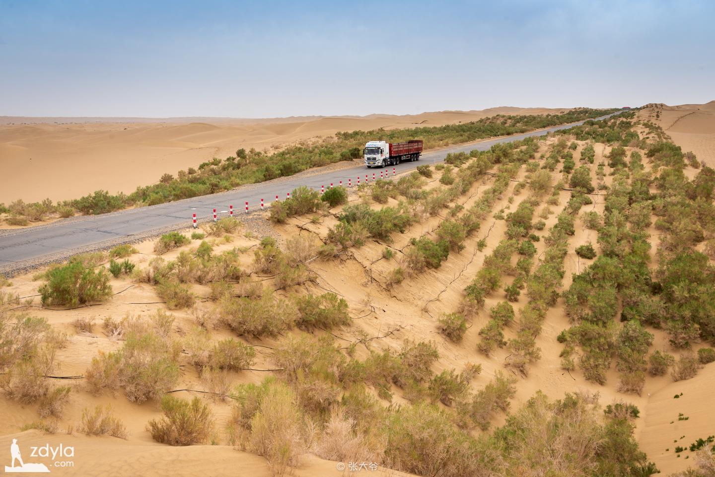
The Taklimakan Desert Highway in Xinjiang, China (i.e. Tarim desert highway) is the longest class highway running through the flowing desert in the world, and also the earliest desert highway in China. It has been the center of the ancient Silk Road since ancient times. Now it is the main battlefield of oil exploration and development, the main oil and gas field base of PetroChina and Sinopec. It passes through Lunnan Oilfield, Tahe Oilfield and Tazhong oilfield, which promotes the development of local economy. At present, it is also one of the destinations for many tourists to visit.
Taklimakan Desert
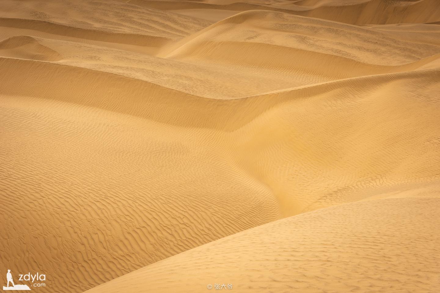
The area of mobile sand dunes in Taklimakan desert is very large. The height of sand dunes is generally 100-200m, and the highest is about 300m. The sand dunes are complex and diverse in types. The compound sand mountain and sand ridge are like giant dragons resting on the earth. The tower type sand dunes are all kinds of honeycomb, feather and fish scale dunes, which are unpredictable.
Bosten Lake

Bosten Lake, which means "oasis" in Uyghur language, is located in Bohu County, Southeast of Yanqi Basin, Xinjiang Uyghur Autonomous Region, China. It is the largest inland freshwater huff and puff Lake in China.
In the biography of western regions in Hanshu, "Yanqi king to Yuanqu City, South to Yuli hundred Li, near sea water with many fish" and "dunhongpu" in Shuijing note refer to this lake.
- Link : https://www.zdyla.com/en/post/i-should-catch-up-with-the-scenery-of-xinjiang.html
- Copyright Notice : Unless otherwise stated, please contact the author for authorization and indicate the source!